Overview
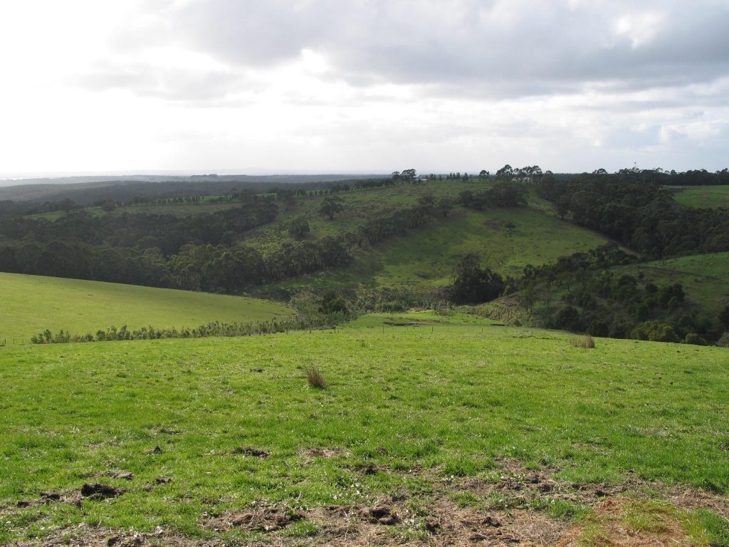
Agriculture is the dominant land use within the Corangamite region, with approximately 3,450 agricultural businesses operating across 772,436 hectares. Farming enterprises include sheep and cattle grazing, dairying, cropping, forestry and viticulture.
Just over 75% of private land used for food and fibre production is used for livestock grazing and 20% is used for crop production, including timber. In addition, the region has smaller areas dedicated to the poultry and pig industries. Livestock numbers in 2005-2006 were approximately 271,000 dairy cattle, 209,000 beef cattle and 1.7 million sheep and lambs. In 2005-2006, the Corangamite region produced approximately 10% of the gross value of agricultural commodities produced in Victoria.
- Agriculture is a reasonably high employer and key economic driver in the Corangamite region, with an annual value of almost $1.5 billion.
- Mixed farming and grazing is the predominant agricultural land use in the Corangamite region (66%), followed by dairy (14%), beef (7%) and sheep (5%) production.
- Meat ($660 million) and dairy products ($546 million) are the most valuable commodities in the region, contributing to 14% and 15% of Victoria’s total value respectively.
- The region produces 16% of Victoria’s hay and silage (tonnes) and 19% of its eggs (dozens).
- Slight contraction in grazing commodities over time may be driven by diversification and prevailing dry conditions.
- There has been a marked decline in broadacre cropping in recent years, however this is offset by increases in hay due to changes in seasonal conditions and grain quality.

Assessment of current condition and trends
A summary of the agriculture and land use profile in the region includes:
- The top three areas as a percentage of people employed in agriculture within the region are Corangamite-South (38%), Corangamite-North (32%) and Colac Region (29%).
- The average age of farmers continues to increase in line with other parts of Victoria (49 years old), however it is lower in some sectors such as intensive horticulture and poultry, and in more commercial enterprises (e.g. >$400K turnover per year).
- Mixed farming and grazing is the predominant agricultural land use in the Corangamite region (66%), followed by dairy (14%), beef (7%) and sheep (5%) production.
- Meat ($660 million) and dairy products ($546 million) are the most valuable commodities in the region, contributing to 14% and 15% of Victoria’s total value respectively.
- The region produces 16% of Victoria’s hay and silage (tonnes) and 19% of its eggs (dozens).
- Slight contraction in grazing commodities over time may be driven by diversification and prevailing dry conditions.
- There has been a marked decline in broadacre cropping in recent years, however this is offset by increases in hay due to changes in seasonal conditions and grain quality.
- The barriers to natural resource management (NRM) practice change are largely consistent with other regions and findings of previous studies. Cost (39%), the view that ‘I have done everything I can do’ (34%), lack of time (20%) and ‘I am getting too old/planning to retire’ (16%) will continue to be important barriers to address in the Corangamite region.
- There is an opportunity to build on the current sustainable agricultural practices in the region, including pasture management, cultivation, crop stubble and/or trash management, soil enhancer use and fertiliser use.
DELWP’s Victorian Land Cover Time Series provides a snapshot of changes in land cover types between 1985 and the present. Between 1985-1990, Corangamite’s top three land cover classes were non-native pasture (occupying over 51% of the region), native trees (19% of the region) and native grass herb (4% of the region). In the most recent 5 year epoch, 2015-2019, non-native pastures have decreased significantly to just under 43% of total coverage, native trees have slightly increased to just under 20% of the region, and dryland cropping now occupies the third most prevalent land cover, occupying over 10% of the Corangamite region (from a previous 2.9%). This represents an increase in dryland cropping of over 100,000 ha.
Over the 30-year period, native vegetation cover classes generally reduced, as did wetlands (perennial and seasonal), while mangroves and saltmarsh stayed fairly constant (although both land cover classes are the least represented). Wetlands showed a significant relative decrease, with perennial wetlands decreasing by 23%, and seasonal wetlands decreasing by 15%. Dryland cropping, exotic woody vegetation and both hardwood and pine plantation coverages increased. Urban and built up areas, whilst a small proportion of the region, increased over this period.
Major threats and drivers of change
Most major threats are natural processes (albeit some are the consequences of land clearing, agricultural, forestry and urban development and on-going activity). The consequences of these threats impacting on land and agriculture have also become greater. For instance, built infrastructure has spread across wider areas with a larger proportion of the population served by various utilities, roads etc. A growing and expanding human population requires larger volumes of water. High value biodiversity, wetlands and cultural heritage sites are considered more significant and valuable as their number has declined.
With regard to soils there are twelve key threats: landslides; water erosion (sheet/rill and gully/tunnel erosion); acid sulfate soils; secondary salinity; waterlogging; soil structure decline; wind erosion; soil nutrient decline; soil acidification; soil contamination; soil organic carbon decline; and soil biota decline.
Major drivers with regard to how land is used have been identified through the Corangamite 2019 Social Benchmarking Survey conducted by Professor Allan Curtis. In this report some of the key changes within the region since the last survey in 2006 are:
- fewer farmers
- enterprise changes
- smaller properties
- less income from agriculture
- older farmers.
Properties closer to major centres such as Geelong and Ballarat are generally smaller, reflecting the demand for lifestyle size properties which have led to more subdivision of farming properties in these areas. Property sizes are generally larger the further west you move across the region.


