Overview
| Overall Area | 256,247 hectares |
| Population | 9,156 |
| Climate | 1,732 mm per annum at Beech Forest 1,078 mm per annum at Gellibrand 628 mm per annum at Aireys Inlet |
| Main Towns | Anglesea Lorne Apollo Bay |
| Land Use | Conservation Grazing of sheep and cattle Forestry |
| Main Industries | Tourism Agriculure Forestry Commercial fishing |
| Main Natural Features | Otway Ranges The Great Otway National Park Aire River Gellibrand River Barham River Anglesea River Various Smaller Coastal Rivers and Streams |
Landscape
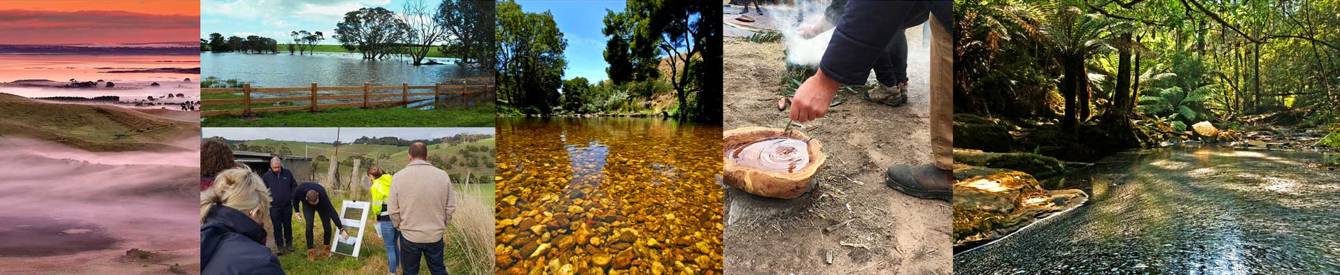
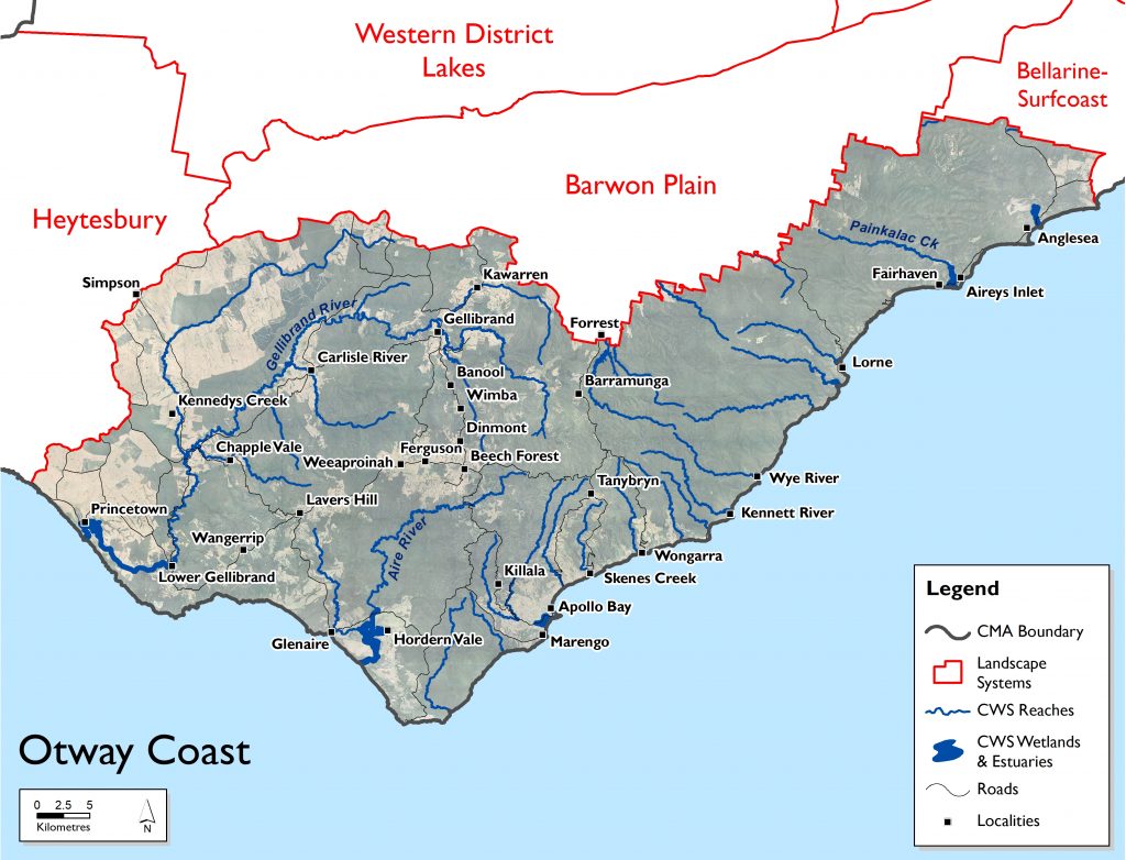
The Otway Coast landscape system occurs along the southern edge of the region between the Geelong, Bellarine and Heytesbury landscape systems. To its north is the Barwon Plains system and it comprises part of the Otway Coast drainage basin and is within the Otway Ranges bioregion. It sits within the shires of Colac-Otway and Surf Coast ; the Traditional Owners are the Wadawurrung in the east and the Eastern Maar to the west of Painkalac Creek.
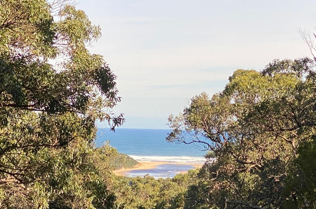
The Great Otway National Park extends across the landscape system and features rugged coastlines, sandy beaches, rock platforms and windswept heathland in the south. In the north, the park features tall forests, ferny gullies, magnificent waterfalls and tranquil lakes. This area, which includes the Great Ocean Road, draws visitors from all over the world for its significant environmental, cultural, social and economic values.
Many of the major waterways in this system are drinking water sources (eg Gellibrand and Barham catchments) and they contain threatened native fish populations (Australian grayling, Australian mudfish and Yarra Pygmy Perch) as well as River blackfish in the Gellibrand catchment.( The latter is not yet considered threatened under legislation but has undergone significant population decline over recent decades.)
Of particular significance is the Aire River, being the only river in the Corangamite region listed under the Heritage Rivers Act 1992, and possessing important nature conservation, scenic, recreational and cultural values.
A number of important wetlands are sited along the coastal fringe near Hordern Vale west of Cape Otway including Lake Costin, Lake Craven, Lake Calder and Lake Horden. Rivers such as the Elliot and Parker to the east of Cape Otway also retain high levels of naturalness.
Key values identified in the Otway Coast landscape system include:
• known rare and threatened species
• significant Ecological Vegetation Classes
• significant native fish and bird species
• recreation including swimming, camping, fishing, picnicking, sightseeing, walking tracks, game hunting and non-motor boating
• urban or rural township water sources
• significant aquatic invertebrate communities.
Livelihood
As a result of the national park, conservation is the largest land use in the zone, which is indicative of the rugged landscape and coastline remaining largely inaccessible to early European settlers, protecting large areas of native forest for the conservation of wildlife. This also means that a large portion of this landscape system is under the management of Parks Victoria.
While the Otway Coast is predominantly public land, the soil productivity on private agricultural land is relatively high for the Corangamite region. Its few patches of relatively low soil productivity are around Anglesea on the coast on the eastern edge, while the western edge of the Otway Coast (bordering the Heytesbury area) is consistently of highest productivity.
The major threats to land and its use within this landscape system is landslides, soil structure decline, soil nutrient decline, water logging, soil acidification, sheet/rill erosion and gully/tunnel erosion.
The land use in this area is predominantly for conservation purposes and forestry with the majority of land managed for this purpose within national parks and reserves systems. Grazing of sheep and cattle is the major agricultural pursuit in this landscape zone followed by dairying. The major private land use is forestry with large plantations of pines and blue gums for commercial harvesting across the area.
As with a number of coastal areas, there is a high proportion of absentee land owners with many using this area as their holiday location. The large number of tourists that flock to the area also has a proportional impact on the wellbeing of these townships, with many geared towards servicing the tourism industry.
Lifestyle
The Otway Coast has a population of around 9,100 – around 2.25% of the total Corangamite region population and is the third least populated area. The most densely populated areas of the Otway Coast are along the coastline, in the townships of Apollo Bay, Lorne, Airey’s Inlet and Anglesea.
The climate is relatively wet and cool with high rainfall (1050 mm over 125 days at Apollo Bay and 924 mm over 117 days at Lorne) and lower maximum temperatures (18o max at Apollo Bay and Lorne, 11o and 9o min at Apollo Bay and Lorne respectively). The major towns are Anglesea, Lorne and Apollo Bay. Property prices play a key role in land ownership with the high values associated with purchasing in this area often prohibitive. This is also a trend with properties within the coastal hinterland, with larger properties being purchased for lifestyle purposes.
Landcare groups within this landscape include Princetown, Hordern Vale Glenaire, Otway Barham Catchment, Otway Coast Regenerative Farmers, Beech Forest Ferguson (The Ridge), Apollo Bay, Wye to Wongarra, Forrest, East Otway and Torquay Landcare Groups.
Assessment of current condition and trends
Water
The waterways of the Otway Coast fall predominantly within the Otway Coast Basin, with some of the waterways in the northwest of the area falling in the Barwon River Basin. This area contains the most individual waterways of the entire Corangamite region, flowing through the mostly forested Otway ranges. Major waterways for this region include the Gellibrand River in the west, Aire River in the centre and Painkalac Creek in the east.
The water quality in this landscape system is generally good as large portions of the area are national parks or forested. Some parts such as the Gellibrand River, Aire River, Barham River and associated tributaries have been subjected to grazing pressures with livestock accessing waterways causing damage and impacting on water quality.
The Anglesea River is also subject to acidification events which have a major impact on water quality and usability.
Water management activities compounding the impact of drought occur most notably for Painkalac Creek. The Otway Coast Basin also holds the greatest proportion of near natural flow regimes in the Corangamite region. Parts of the Gellibrand River show summer stress with long periods of low flows.
The West Barwon Dam is a significant water body within the Barwon River Basin area of the Otway Coast, and provides drinking water for greater Geelong. The Barwon River has been assessed as having flow regimes that were highly modified due to water off-takes.
The Gellibrand River estuary intermittently opens or closes depending on the prevailing freshwater river flows and tidal movements. Estuary closure can result in flooding of adjacent land which results in artificial estuary openings. However, this inundation is a natural process and plays an important role in the life cycle of many plant and animal species that reside or visit the estuary as well as the cycling of nutrients and deposit of sediments. In 2017 the Corangamite CMA developed the Gellibrand River Estuary Management Plan to guide management of the estuary and surrounding wetlands including the Latrobe Creek wetlands.
Corangamite Waterwatch, a citizen science volunteer program, regularly monitors water quality parameters at many sites across the catchment. The water quality of the waterways in the Otways Coast were mostly healthy; salinity levels in the riverine sections of the waterways were mostly low, though marginally above the SEPP (Waters) objectives, whilst the oxygen levels in the water were marginally below the objectives. Turbidity levels were low and pH levels were mostly healthy; phosphorus levels in some waterways may be of concern. All waterways displayed a seasonal trend of increased electrical conductivity over the summer and autumn seasons resulting from reduced river flows. During these times dissolved oxygen levels were also lower though mostly remained within the healthy range.
In Wye River the water quality was mostly good displaying relatively low salinity and turbidity, healthy pH and oxygen levels, with phosphorus levels marginally high. The macroinvertebrate community indicates the catchment to be mostly healthy. In the estuary, mouth closures occur most years during the summer season and are generally short lived. As summer river flows decline, a salt wedge develops from tidal driven sea water entering the estuary. The water quality in the estuary was mostly very good, even though salinity stratification was evident. Oxygen remained within healthy levels. All water quality parameters remained mostly within the healthy range over the period monitoring was conducted.
In St George River, the water quality monitoring was undertaken in the estuary only during the summer to autumn season and captures a time after seasonal river flows have declined and the salt wedge had already developed. Significant salinity stratification resulted in very low dissolved oxygen levels (<10% saturation) in the bottom waters, particularly at the upstream site; these low levels would be harmful to salt water dependent species. At the most downstream site the stratification also resulted in lower dissolved oxygen levels in the bottom waters, though not as low as that observed upstream. During this time the pH remained mostly within the healthy range, with low turbidity.
In the Erskine River, on most occasions the water quality was good, displaying relatively low electrical conductivity, turbidity and phosphorus levels and healthy pH and dissolved oxygen levels. At the most downstream riverine site, increases in electrical conductivity were observed, likely due to reduced river flows and possibly due to estuarine influences. Increases in phosphorus over summer were also evident. The aquatic macroinvertebrate community (2016 survey) indicates the Erskine River catchment to be healthy. The estuary is mostly tidal dominated with a brief period over winter and spring when freshwater dominates – at these times oxygen levels are healthy. As the salt water penetrates the estuary, stratification occurs, resulting in lower levels. Over summer in the upper estuary the water column was stratified. This stratification resulted in very low oxygen levels (<10% saturation) in the bottom waters; these low levels may be harmful to salt water dependent species. Nearer the estuary mouth the water column was also stratified, however the bottom oxygen levels were much higher – this is due to tidal influences bringing freshly oxygenated sea water into the estuary on each high tide. During this time the pH remained mostly within the healthy range, with mostly low turbidity.
In the estuarine reaches, greater variability was observed, particularly over the summer and seasons when river flows decline and sea water moves up the estuaries. In many instances salinity stratification occurs, reducing the potential for oxygenation of the saline bottom waters – the further the distance from the estuary mouth and the deeper the estuary, the lower the oxygen levels. All of the estuaries intermittently close to the ocean with artificial openings common, particularly Painkalac Creek and Anglesea River.
The water quality in the freshwater reaches of Painkalac Creek was marginal (limited monitoring may not reflect the true condition of the water quality in Painkalac Creek); whilst displaying healthy pH and low phosphorus levels, oxygen levels were regularly below 50% saturation. The salinity was also marginally high for a stream in the Otway Ranges and turbidity levels indicate sediment movement possibly associated with unrestricted stock access and reduced riparian vegetation. Aquatic macroinvertebrate monitoring indicated the waterways to be mildly impacted.
The mouth condition assessments indicate the Painkalac estuary is closed to the ocean for most of the time. The longest duration of closure of the estuary mouth was from September 2014 to July 2016. Outside of this time the estuary mouth generally opens to the ocean once or twice per year, these openings are mostly artificial and are conducted due to the risk of inundation of built infrastructure on the estuary floodplain. Over the summer to autumn seasons, the water level within the estuary often reduces due to low or no freshwater inflows and increased evaporation. As river flows increase during winter and spring, the water level increases within the closed estuary.
The water quality in the Painkalac estuary was mostly good, though at times was marginal and displayed several seasonal trends. During winter and spring there is a short period of near freshwater dominance due to rainfall in the catchment and increased river flows. Following the opening of the estuary mouth, salt water penetrates up the estuary and stratification is evident with the bottom water salinity higher than the top water. For most of the time the estuary water is brackish. In 2013 salinity monitoring indicated the water to be hypersaline resulting from low inflows and evaporation. Due to the salinity stratification, dissolved oxygen levels in the bottom waters were at times critically low, particularly in the upper reaches of the estuary. On several occasions there was high potential for algal growth.
The pH levels in Painkalac estuary also displayed a seasonal trend with low levels (acidic conditions) occurring during late autumn and winter, usually at times of the first significant rainfall event, due to the release of acidic waters from the catchment following the dryer summer seasons. Very low levels (<6.0 pH units) occur most years at these times with the lowest recorded in April 2017 (4.3 pH units) and are likely to impact on the plants and animals present. Often the stratification of the water column contains the acidic conditions in the top waters. These conditions marginally improve as the waters move toward the estuary mouth, though they are evident throughout the estuary. The turbidity was mostly low, with higher levels recorded at times of increased river flows indicating sediments are being delivered to the estuary, likely due to land-use practices in the catchment.
The monitoring undertaken in the upper catchment of the Gellibrand River in Love Creek indicates the waterway to be in marginal to good condition, whilst displaying low salinity, turbidity, reactive phosphate and healthy pH levels. Llow oxygen levels on occasions potentially indicate high instream oxygen demand, particularly over summer when river flows are reduced. Macroinvertebrate monitoring identified several pollution sensitive bugs to be present; the complete community composition indicates the creek to be healthy.
Further down the catchment the Carlisle River joins the Gellibrand River. Monitoring of the water quality in the Carlisle River indicates it to also be in good condition, similar to Love Creek, with occasional low oxygen levels particularly during times of low river flow over summer and autumn.
Downstream from the confluence with the Carlisle River on the Gellibrand River, the water quality is maintained in good condition. Lower down the catchment the water quality, whilst mostly healthy, shows some decline with increased turbidity indicating increased sediment entering the waterway.
As the Gellibrand River enters the estuary at the Great Ocean Road approximately fourteen kilometres from the estuary mouth there is a slight increase in turbidity. This area of the estuary is shallow compared to further downstream and saline water has rarely been recorded at this site.
However over the next eight kilometres, declines in water quality are evident with decreases in pH levels indicating acid sulphate soils are likely in the area. Estuary flood plains are commonly associated with acid sulphate soils; disturbances such as channel drains used to reduce flooding often expose these soils which upon wetting release sulphuric acid into the waterway, lowering pH levels.
There is evidence the salt wedge penetrates this area some ten kilometres from the estuary mouth at times of low river flows. This results in stratification on a salinity gradient. The effects of stratification are also evident in Latrobe Creek at the township of Princetown. At times of estuary closures the effects of stratification particularly as river flows start to increase can impact the whole estuary as the saline bottom waters become separated from the surface, oxygen levels soon decrease to a level that can be lethal to saltwater dependent fish. Fluctuations in dissolved oxygen is a natural occurrence in salt wedge estuaries, such as the Gellibrand River estuary. The overall water quality in the Gellibrand River estuary is marginal to good. Eery year over the summer to autumn seasons the estuary mouth closes due to reduced river flows – it is during these times when the water quality is most variable.
Biodiversity
This is one of the region’s more diverse landscapes containing three bioregions. It is dominated by Otway Ranges (about 60%), covering most the of the south coast and central area, Otway Plain is second most featured (about 30%), covering the north-eastern edge of the landscape system, the central north western area and small sections scattered on the coast. The Warrnambool Plain occurs on the western boundary and makes up about 10% of the landscape.
Within the Otway Coast landscape, the majority of waterways have excellent vegetation condition, with six reaches assessed as being in reference condition. However, some estuarine reaches in this area exhibit vegetation of poor condition. Dewing Creek’s was found to be in reference condition, with three other reaches in near-reference condition.
The landscape has threatened Ecological Vegetation Classes (EVC) with Wet Forest bounded by areas of Shrubby Wet Forest and Shrubby Foothill Forest EVCs being the most dominant vegetation types. Cool Temperate Rainforest occurs largely within the gullies, while Wet Sands Thicket and Riparian Forest are found along with small patches of Wet Heathland EVCs. Along the coast Damp Sands Herb-rich Woodland and Coastal Headland Scrub can be found along with small sections of Sand Heathland at the eastern extent of the landscape. The Victorian Biodiversity Atlas has records of 37 Federally protected species, 69 State protected species and 173 rare or threatened species on the Victorian Advisory List occurring within the landscape.
DELWP’s Habitat Distribution Models identify species with more than 5% of their Victorian range in the area, including notable plant species such as Pallid Sun-orchid (endangered, 100% of range), Large Plumeorchid (rare, 98% of range), Anglesea Leekorchid (endangered, 94% of range), Angahook Pink-fingers (endangered, 92% of range), Anglesea Grevillea (vulnerable, 76% of range), Otway Grey-gum (vulnerable, 76% of range).
Rare or threatened species with more than 20% of their Victorian modelled range in the landscape include: Dwarf Silver Wattle (Acacia nano-dealbata), Ground spleenwort (Asplenium appendiculatum subsp. appendiculatum), Tall Astelia (Astelia Australiana), Coast Correa (Correa backhouseana var. backhouseana), Slender Treefern (Cyathea cunninghamii), Brooker’s gum (Eucalyptus brookeriana), Snowberry (Gaultheria hispida), Bristly Shield-fern (Lastreopsis hispida), Wrinkled Buttons (Leiocarpa gatesii), Hairy Shepherd’s Purse (Microlepidium pilosulum), Goldy Wood (Monotoca glauca), Satinwood (Nematolepis squamea subsp. squamea), Dwarf Sickle Fern (Pellaea nana), Rufous Bristlebird (Otway) (Dasyornis broadbenti caryochrous), Pale Groundsel (Senecio hypoleucus), Tasman Fan-fern (Sticherus tener s.s.), Fairy Lanterns (Thismia rodwayi).
One reptile, the Mountain Dragon Anglesea form, has 98% of its range in the region (data deficient). Two notable bird species with more than 5% of their Victorian range in the area are the Rufous Bristlebird (near threatened, 6%), and Rufous Bristlebird ((Otway) near threatened, 6%).
Land
While the Otway Coast is predominantly public land, the soil productivity on private agricultural land is relatively high for the Corangamite region. Its few patches of relatively low soil productivity are around Anglesea on the coast on the eastern edge, while the western edge of the Otway Coast (bordering the Heytesbury area) is consistently of highest productivity.
DELWP’s Victorian Land Cover Time Series provide a snapshot of the changes in land cover types in seven five-year increments between 1985-2019.
The most prevalent land cover class in the Otway Coast landscape system is native trees, followed by non-native pastures and both hardwood and pine plantations. Over the 30-year period, native trees total area has increased marginally, constituting around 73% of the entire landscape system. Non-native pasture dropped from 19% of the total area, to 17%, while both hardwood and pine plantations increased, now occupying a combined 6% of the Otway Coast (from a previous 4.5%). Urban areas have experienced moderate growth, now occupying 0.5% of the area. Exotic woody vegetation land cover also occupies 0.5% of the total landscape area. Although constituting only a small proportion of the Otway Coast, native grass herb, and seasonal wetlands both decreased, more than halving their earlier size.
Coast and Marine
The Otway Coast coastline constitutes two bioregions, dominated mainly by Otway Plain and Otway Range; with the latter maintaining a majority of its original vegetation cover (81.6%). Within the this system the highest percentages of remnant vegetation is within public land (79.1% and 61.9% respectively). Most of the remnant coastal biodiversity in the system is reserved in national, state and other parks, state forests, and other public land reserves. including the Great Otway National Park and the Angahook-Lorne State Park.
The condition of coastal waters is generally good, with low levels of nutrients, turbidity and bio-contaminants, and generally good light conditions. Attention of nutrient and sediment fluxes in the catchments, and appropriate management of storm water and wastewater in coastal towns is essential to preserve this good condition.
Within this system there are a number of marine sanctuaries and national parks. These include the Marengo Reefs and Eagle Rock Marine Sanctuaries. The region also includes the Twelve Apostles Marine National Parks. South of Cape Otway is the Apollo Commonwealth Marine Park.
Community
The Otway Coast has a population of around 9,100 – around 2.25% of the total Corangamite region population and the third least populated area. The most densely populated areas of the Otway Coast are along the coastline, in the townships of Apollo Bay, Lorne, Airey’s Inlet and Anglesea.
Landcare groups within this Landscape include Princetown, Hordern Vale Glenaire, Otway Barham Catchment, Otway Coast Regenerative Farmers, Beech Forest Ferguson (The Ridge), Apollo Bay, Wye to Wongarra, Forrest, East Otway and Torquay Landcare Groups.
These groups receive support from the Heytesbury District Landcare Network, Central Otways Landcare Network, Southern Otway Landcare Network, Upper Barwon Landcare Network and Surf Coast and Inland Plains Network.
Other environmental groups:
- ANGAIR (Anglesea, Aireys Inlet Society for the Protection of Flora and Fauna)
- Conservation Ecology Centre
- Friends of Aireys Inlet Coastal Reserve
- Friends of Allen Noble Sanctuary
- Friends of Eagle Rock Marine Sanctuary (FERMS)
- Friends of Eastern Otways (Great Otway National Park)
- Friends of Kennett River
- Friends Of Otway National Park
- Friends of the Hooded Plover – Otway Coast
- Friends of the Hooded Plover – Surf Coast
- Land and Water Resources Otway Catchment
- Lornecare
- Otway Agroforestry Network
- Otway Coast Committee Inc
- Otway Conservation Association
- Save the Painkalac Creek
- Skenes Creek Advancement Association
- Surf Coast & Inland Plains Network (SCIPN)
- Wye River Separation Creek Vegetation Restoration Committee
- Wye Weed Warriors
Major threats and drivers of change
Impacts predicted by climate change modelling are a major concern for this system and have been identified as the waterways in the region most vulnerable to climate change impacts (Corangamite NRM Plan for Climate Change). This includes sea level rise changing the dynamics and ecosystems of estuaries and built coastal environments; changes to rainfall patterns and increasing temperatures affecting water security and availability (loss of threatened fish habitat and restrictions to migratory species movement and loss of available water for human and stock consumption, noting that flows are already an issue in some rivers). The threat posed from a predicted increase to the frequency and intensity of bushfire is high for this system as a majority of it is forested.
Parts of the Otway Coast waterways and estuaries have been subjected to grazing pressures. Livestock access to waterways can erode banks, damage riparian vegetation and reduce water quality through sedimentation and effluent contamination. Willows have been identified as a threat to a number of waterways in this landscape system especially the Barham and Aire rivers.
The high rainfall and steep terrain lead to high rates of erosion and potential for landslides; there are coastal acid sulphate soils in some areas; soil nutrient decline and water logging are the major threats to the soils and how land is used. Along waterways and drainage lines there are large tracts of willows and blackberry along with areas where stock can access frontage and contribute to erosion, sediment, pathogen and nutrient loads. Development pressures in some areas of this system are also of concern.
Water extraction from the rivers and streams for water supply purposes has the capacity to reduce flows over the summer months, impacting on their health. Other year round extraction for stock and domestic use also impact flows.
Urban growth, as experienced along the Erskine River in Lorne, the Barham River at Apollo Bay and the Anglesea River at Anglesea, has placed pressure on existing infrastructure and land use, with the potential for associated impacts to adversely affect the values of the area. Threats linked to urban development and increased recreational use include storm water run-off and degraded water quality, soil disturbance, bank erosion and degradation of native vegetation including estuarine vegetation.
All of the estuaries in the Otway Coast landscape system intermittently open or close depending on the prevailing conditions, e.g., freshwater flows, weather changes and tidal movements. Estuary closure can result in social and economic impacts through flooding of adjacent land. However, inundation is a natural process and has an important role in the life cycle of many species and the cycling of nutrients. Artificially opening the estuary under certain conditions can result in adverse impacts to the surrounding environment and species that live there.
Water
Parts of the Gellibrand, Aire and Barham Rivers and their associated tributaries and estuaries have been subjected to grazing pressures. Livestock access to waterways can erode banks, damage riparian vegetation and reduce water quality through sedimentation and effluent contamination, which can also impact on potable water supplies within the Gellibrand Special Water Supply Catchment.
Water extraction from the Gellibrand River for water supply purposes has the capacity to reduce flows over the summer months impacting on the health of the river. Other year round extraction for stock and domestic use also impact flows along the Gellibrand River.
Willows have been identified as a threat in the reaches of the Gellibrand, Aire and Barham Rivers and in the longer term dispersal may compromise the condition of waterways throughout these river systems.
All the estuaries within this landscape system intermittently open or close depending on the prevailing conditions. Estuary closure can result in social and economic impacts through flooding of adjacent land. However, inundation is a natural process and has an important role in the life cycle of many species and the cycling of nutrients. Artificially opening these estuaries under certain conditions can result in adverse impacts to the surrounding environment and the species that live there.
Urban growth, as experienced along the Erskine River in Lorne, has placed pressure on existing infrastructure and land use, with the potential for associated impacts to adversely affect the values of the area. Threats linked to urban development and increased recreational use include storm-water run-off and degraded water quality, soil disturbance, bank erosion and degradation of native vegetation including estuarine vegetation.
The Corangamite Waterway Strategy 2014-2022 outlines priority management activities to address water quality threats in the Otway landscape. These include:
- Establish native indigenous vegetation
- Install riparian/wetland fencing
- Establish stewardship/management agreement
- Continue to adopt a risk-based approach to estuary mouth opening (Painkalac Creek, Anglesea River, Barham River, Erskine River, Princetown wetlands, Gellibrand River)
- Establish non-woody weed control
- Undertake woody weed control (Barham River East Branch, Wye River, Kennett River, Gellibrand River, Kennedys Creek, Chapple Creek, Love Creek)
- Investigate sediment sources and sinks – particularly in Upper Gellibrand (including Love and Lardner catchments)
- Review and update current estuary management plan – Gellibrand River
- Investigate options to address summer low flow shortfalls – as identified under the Western Region Sustainable Water Strategy (Gellibrand River)
- Modify outlet waterway structure/rock ramp (Barham River East Branch)
- Modify culvert crossing/baffles in fishway (Barham River East Branch)
- Remove fish barrier by replacing existing crossing with clear span bridge (Barham River East Branch, St George River)
- Investigate and manage urban stormwater/water quality impacts in line with whole of water cycle management principles (Erskine River)
- Implement the Anglesea estuary management plan – Anglesea River
- Investigate potential processes impacting acid sulfate soil issues and methods to minimise further risk (Anglesea River)
- Investigate impacts to environmental flows throughout the broader Otway Coast catchment basin to secure and better manage environmental water where required (St George River, Gellibrand River)
- Investigate stream bed instabilities (Painkalac Creek)
- Assess options for long-term management of land subject to inundation (Gellibrand River)
- Conduct monitoring and maintenance to ensure that waterway remains in current condition (Grey River, Carisbrook Creek, Smythes Creek, Erskine River, Kennedys Creek, Sandy Creek, Carlisle River, Gum Gully Creek, Lardner Creek)
- Comply with bulk entitlements, monitor and maintain waterway condition and implement risk management plans as appropriate (West Gellibrand Reservoir)
- Maintain EstuaryWatch groups collecting baseline data on estuary condition
- Maintain Waterwatch groups collecting baseline data on waterway condition.
Biodiversity
Threats to biodiversity in this region include native vegetation removal, barriers to on-ground management, water quality and quantity, rising sea levels, littering, and inappropriate land use.
Willows (Salix spp.) are a Weed of National Significance and are known to adversely impact waterways through reducing water quality and availability, increasing erosion and flooding potential, and reducing aquatic and riparian biodiversity. The red fox (Vulpes vulpes) was identified as a threat to significant bird species.
DELWP’s 2019/2020 Biodiversity Response Planning identifies the most cost-effective threat control actions for significant biodiversity improvement in the region. The most beneficial action in this region is permanent protection. Control of pigs, rabbits, overabundant kangaroos, deer and weeds are the next most beneficial management actions, when considering net benefit to all flora and fauna.
Land
The major threats to land and its use within this landscape system are landslides, soil structure decline, soil nutrient decline, water logging, soil acidification, sheet/rill erosion and gully/tunnel erosion (see Static Maps section for mapped soil threats).
Landslides are particularly a problem in those areas that are steep, have high levels of rainfall and have been cleared. This is particularly the case around the lower Gellibrand River and its tributaries and the Johanna River as well as the upper Aire River valley, the West Branch of the Ford River, and the lower Aire River in the Hordern Vale district. There is also potential for landslides around Eastern View, Wye River, Separation Creek, Kennett River, Lorne and the hinterland of Apollo Bay including Wongarra, Wild Dog Creek valley, Tanybryn and the Barham River valley.
Areas around Kennedys Creek and the Gellibrand River are susceptible to gully erosion.
Land used for dairy farming is highly susceptible to water logging.
Coast and Marine
The Victorian Marine and Coastal Policy identifies that the health of the marine and coastal environment is under threat from multiple sources, including climate change and growth in towns, cities and industries that interact with their local marine and coastal ecosystems.
These threats can lead to negative impacts on water quality and quantity, pollution and debris, invasive species, marine pests and diseases, disturbance and loss of plants and animals, and loss of access to beaches from the effects of sea walls, infrastructure and erosion. Degradation occurs over time and space, and the impacts in marine and coastal areas are varied and complex.
Climate change is increasing the pressure on the marine and coastal environment by exacerbating existing threats and introducing new ones, including:
• rising sea levels, leading to more inundation and erosion
• increased frequency and severity of storms and other extreme weather events
• changes in ocean temperatures, currents and acidification
• changes to waterway flows, levels and regimes
• changes in the range, distribution and abundance of both introduced and native plants and animals, taking advantage of a changed climate.
Growth in resident populations and visitor numbers puts pressure on the health of the marine and coastal environment. Population growth also increases pressure on recreational infrastructure such as walking tracks and visitor facilities. This, in turn, leads to more demand for alterations to beaches, foreshores, wetlands and natural processes through groynes, sea walls and dredging to support use and development.
Community
The Otway Coast has a population of around 9,100 and is the third least populated landscape of the Corangamite region. The most densely populated areas are along the coastline, in the townships of Apollo Bay, Lorne, Airey’s Inlet and Anglesea. Large areas of public land and national parks serve to define the communities.
As with a number of coastal areas there is a high proportion of absentee land owners with many using this area as their holiday location. The large number of tourists flockung to the area also has a proportional impact on the wellbeing of these townships, with many geared towards servicing the tourism industry.
Property prices play a key role in land ownership, and the high values associated with purchasing in this area are often prohibitive. This is also a trend for larger properties being purchased for lifestyle purposes within the coastal hinterland.
To the west of this landscape there are active landcare groups including Princetown, Hordern Vale Glenaire, Otway Barham Catchment, Otway Coast Regenerative Farmers, Beech Forest Ferguson (The Ridge), Apollo Bay, Wye to Wongarra along with the Otway Agroforestry Network supporting the communities of these areas. There is more full time agriculture conducted in these areas with the value of profitability versus land prices always being a tension.
Otway Coast 6 Year Outcomes
Water
By 2027, compared to 2022 baselines:
The efficiency of consumptive water use in the Otway Coast Landscape System will be improved through the use of cost effective alternate water sources and demand management strategies that results in less take from source water. OtwWO1
There is an improvement in riparian extent and condition, hydrological regime and water quality in Otway Coast priority waterways as defined in the Corangamite Waterway Strategy. OtwWO2
Urban areas will have identified waterway amenity values to enhance user experience and connection to the natural landscape. OtwWO3
Drinking water supply catchments are protected to provide quality water for urban water supplies. OtwWO4
Increase the community understanding and awareness of water values and management for the Otway Coast. OtwWO5
Understand and enhance Eastern Maar values of the main waterways and ensure Eastern Maar People have a strong voice in their management. OtwWO6
Water quality in the Gellibrand River, Aire River and Anglesea River are maintained or improved, compared to index of estuary condition 2019. OtwWO7
Biodiversity
By 2027, compared to 2022 baselines:
Achieve a net gain in the overall extent, connectivity and condition of Otway Coast habitats across land and waterway environments through effective climate change adaptation strategies. OtwBO1
Achieve a net gain where possible in suitable Otway Coast habitat expected over six years from sustained improved public and private land management and community involvement for threatened and culturally significant local species. OtwBO2
Achieve a net gain where possible in all species with positive % change in suitable Otway Coast habitat and improved species balance expected over six years from sustained improved public and private land management and community involvement. OtwBO3
Increase effectiveness of interagency collaboration in their ability to respond to climate change and development pressures on biodiversity. OtwBO4
Increase understanding and awareness of biodiversity values of the Otway Coast Landscape System. OtwBO5
Land
By 2027, compared to 2022 baselines, land within the Otway Coast is sustainably managed for a variety of purposes within its capability and suitability to maintain and improve its natural capital and to prevent both on and off-site impacts. OtwLO1
Coast and Marine
By 2027, compared to 2022 baselines, proactive management of the catchment by the community contributes to a net gain in the health and resilience of the region’s highly valued coastal and marine environment. OtwMO1
Communities
By 2027, compared to 2022 baselines:
Otway Coast communities (and visitors) are encouraged, educated and enabled to further connect with and responsibly care for the natural environment. OtwCO1
Otway Coast communities (and visitors) have an increased awareness and understanding of the connection between human activities and impacts on the environment. OtwCO2
The increased capacity of Eastern Maar and Wadawurrung Traditional Owner groups enables their increased involvement in decision making that effects their Country. OtwCO3
Otway Coast 6 Year Priority Directions
Six year regionally applicable priority directions have been developed for each of the Themes and are applicable to this landscape System, these can be accessed via the following links:
Six year priority directions for the Otway Coast are provided in the following table. Where these priority directions apply to a theme this is indicated by the relevant shading. To access definitions of terms and acronyms click on the following link.
Code |
Priority Direction |
Relevant Theme | ||||||
|---|---|---|---|---|---|---|---|---|
| Water | Biodiversity | Land | Community | Coast and Marine | Lead | Collaborators | ||
| OTW1 | Otway Coast landscape partners and the community collaborate to deliver a coordinated approach to natural resource management to build resilience and successfully respond to changing circumstances with clear roles and responsibilities communicated. | CCMA | DELWP, Water Authorities, EPA, COS, CS, SCS, GORCAPA, PV | |||||
| OTW2 | Develop enduring partnerships with the Wadawurrung and Eastern Maar people to: 1) acknowledge and enhance Wadawurrung and Eastern Maar values of natural assets; 2) ensure the Wadawurrung and Eastern Maar people have a strong say in management of natural assets; 3) identify and implement appropriate mechanisms for sharing Wadawurrung and Eastern Maar stories and history; and, 4) identify and implement opportunities for the Wadawurrung and Eastern Maar people to own and manage water on their country |
CCMA | WTOAC, EMAC, DELWP, Water Authorities, COS, CS, SCS, GORCAPA | |||||
| OTW3 | Within the Coastal and Marine environment 1) review targets in relevant strategies to identify and reduce stressors on coastal and marine environments 2) develop and implement a process for the provision of coastal erosion advice for long term planning, management and adaptation. |
DELWP | CCMA, GORCAPA | |||||
| OTW4 | Ensure development planning considers, minimises and where possible avoids adversely impacting floodplains, biodiversity, land and water assets including encouraging water sensitive urban design and use of integrated water management principles and requiring developers to: 1) protect and enhance native vegetation and habitat 2) protect and enhance floodplain function 3) protect and enhance marine and coastal values 4) protect cultural heritage |
COS, CS, SCS | CCMA | |||||
| OTW5 | Ensure community education and engagement activities are grounded in the most recent and relevant social research available and target local demographics | CCMA | DELWP COS, CS, SCS, Water Authorities, GORCAPA, PV | |||||
| OTW6 | Best land management practices are implemented across farmers, agencies, developers, and the catchment community | CCMA | AgVic, Landcare | |||||
| OTW7 | Implement additional areas of sustained predator, herbivore and weed control in priority locations, reflecting Biodiversity Response Planning outputs, Strategic Management Prospects and other regional plans | DELWP | CCMA, PV, Landcare | |||||
| OTW8 | Encourage landowners to apply best practice land management by: 1) using property management planning; 2) use of Landcare networks; 3) actively researching and facilitating market drivers that promote sustainable ag/land management practices; and, 4) designing and delivering a comprehensive engagement program to support and empower farming communities |
CCMA | AgVic, DELWP, Landcare | |||||
| OTW9 | Explore and implement cost effective water efficiency measures including demand reduction initiatives and alternative water sources by implementing the following plans and strategies: 1) Barwon Water and Wannon Water Urban Water Strategies 2) priority projects identified by the Barwon and Great South Coast Integrated Water Management Forums; and, 3) relevant actions from the 2021 Central and Gippsland Sustainable Water Strategy |
BW, WW | CCMA, DELWP, COS, CS, SCS | |||||
| OTW10 | Protect the drinking water supply catchments from activities which could influence runoff and source water quality | BW, WW | CCMA, Landcare | |||||
| OTW11 | Ensure estuary management is managed consistent with State policy to reduce impact on natural environment and mitigate risk to human related assets | CCMA, PV | COS, CS, SCS, GORCAPA, Water Authorities, DELWP | |||||
| OTW12 | Manage upstream processes to mitigate impacts on the coastal and marine environments. | CCMA | COS, CS, SCS, PV, EPA, Landcare, DELWP | |||||
| OTW13 | Explore carbon sequestration opportunities to deliver both climate and catchment/biodiversity benefits. | Deakin Uni | DELWP, PV, CCMA | |||||
| OTW14 | Maintain community access on public coastal land where biodiversity can be protected, and avoid exclusive private use of public land | DELWP | GORCAPA, PV | |||||
| OTW15 | Encourage and enable community participation (volunteering) 1) in on-ground environmental works to restore and protect environmental assets 2) citizen science programs |
CCMA | Landcare | |||||
| OTW16 | Engage with the community on the need to mitigate and adapt to climate change and its’ impacts. | CCMA | DELWP, Landcare, GORCAPA | |||||
| OTW17 | Build awareness and understanding of cultural landscape management in the Great Otway National Park through increased connection of agencies, authorities, community groups and Traditional Owner Groups. | PV | DELWP, Landcare, GORCAPA | |||||
| OTW18 | Action Plans are developed that leads to a 25% increase of non-government investment to supplement current Government investment into the region to address high priority natural resource management actions | CCMA | DELWP, COS, CS, SCS, Landcare | |||||
| OTW19 | Develop best practice management actions to achieve an overall net gain of ‘Suitable Habitat’ for priority species by 2027 | CCMA | DELWP | |||||