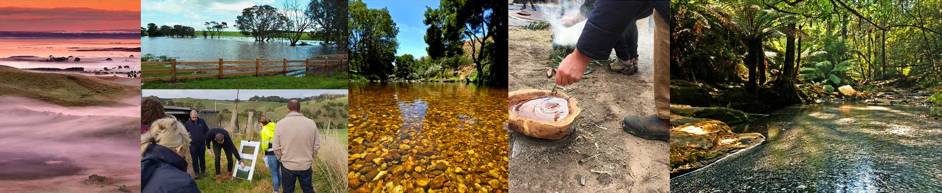
Overview
| Overall Area | 118,524 hectares |
| Population | 19,053 |
| Climate | 780 mm per annum at Barwon Downs 666 mm per annum at Birregurra 550 mm per annum at Winchelsea |
| Main Towns | Colac Birregurra Winchelsea Forrest |
| Land Use | Mixed farming Cattle grazing for both dairy and beef production Cropping |
| Main Industries | Agriculture Tourism |
| Main Natural Features | Barwon River Barongarook Creek Waurn Ponds Creek |
Landscape
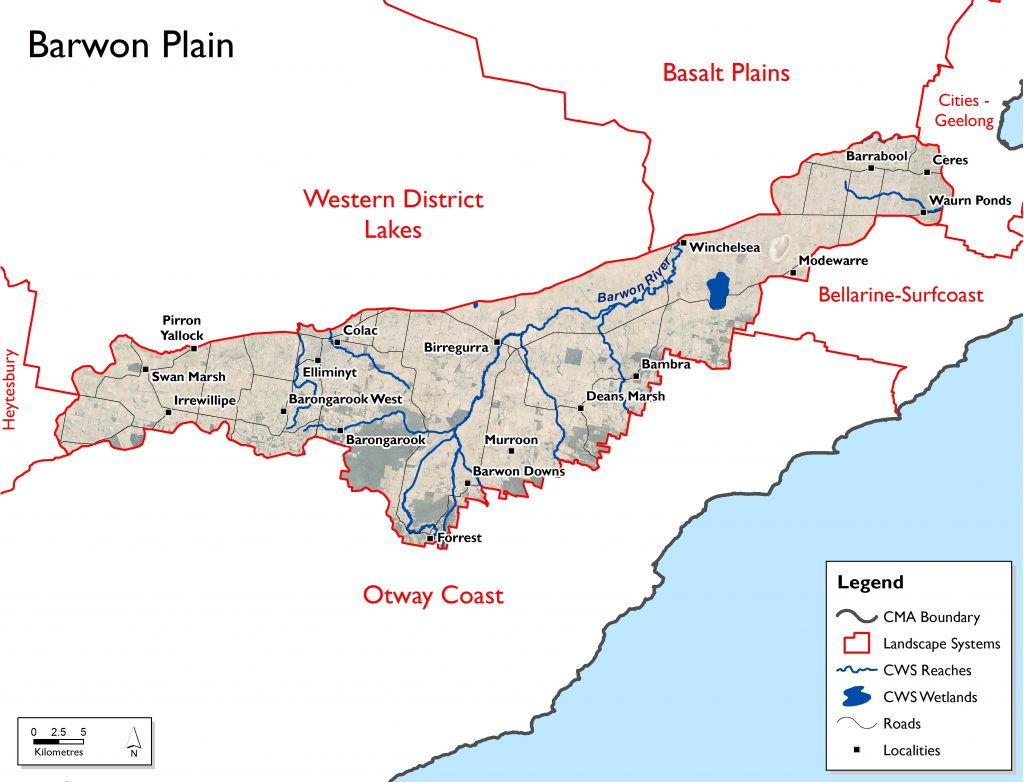
The Barwon Plain landscape system is situated between the Otway Coast, Heytesbury, Western District Lakes, Basalt Plains and Geelong-Bellarine areas. Its northern boundary is generally the Princes Highway while to the south it is the Otway Ranges. Major towns include Colac and Winchelsea, with the Colac-Otway and Surf Coast Shires being the main municipalities. Most of the landscape system is within the Eastern Maar area, but it also includes part of the Wadawurrung traditional lands.
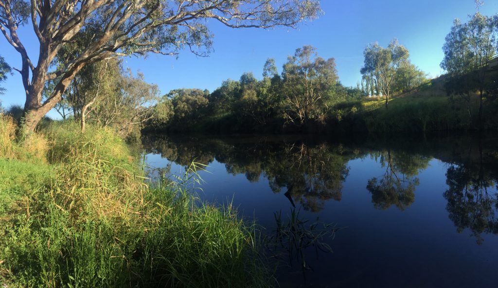
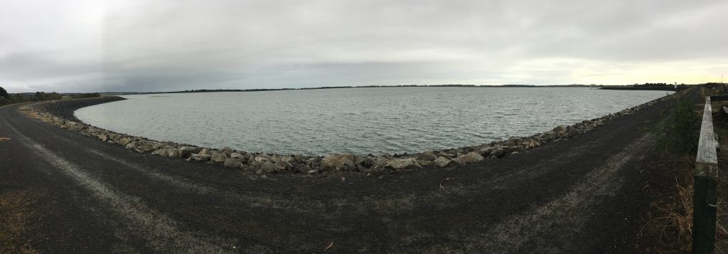
The Barwon River is the main water course running through this area with the flood-plains of the Barwon River and its tributaries extending from the foothills of the northern side of the Otway Ranges to the basalt plains near Winchelsea. Significant water bodies in this landscape include the Wurdiboluc Reservoir, which supplies potable water to Geelong, Anglesea, Torquay and the Bellarine Peninsula. Mixed farming and cattle grazing for both dairy and beef production are the main agricultural industries. The soils also show a gradual transition from acid, freely drained profiles to heavier neutral soils as the influence of basalt-derived alluvium increases towards the north. Key values identified in the Barwon Plains landscape system include:
• known rare and threatened species and platypus
• significant Ecological Vegetation Classes
• significant bird species and important bird habitat
• significant native fish and amphibian species including galaxias
• recreation, including fishing, picnicking, walking tracks
• areas of drought refuge
• urban and rural township water storages.
Livelihood
Grazing for livestock (beef, sheep and dairy) and forestry are key land uses in this area. Soil productivity on private agricultural land in the Barwon Plain ranges from high relative productivity to moderate, and is higher than the northern and eastern parts of the Corangamite region. The Barwon Plain is constituted of predominantly private agricultural land, with the highest relative productivity soils found on the western side, gradually transitioning to moderate in the east.
Lifestyle
The Barwon Plain has a population of just over 19,000 – constituting around 4.7% of the Corangamite region – and is the fifth most populous area of the region. The most densely populated area of the Barwon Plain is the township of Colac.
The community within the Barwon Plain is quite robust and well supported by Landcare and other community groups. As with a number of other systems, the changing demographic of the farming sector is of concern, with the average age of full time farmers increasing, and fewer younger people taking over the operation of farms.
There has also been a growth in hobby farms, especially in the east of the Barwon Plain in closer proximity to Geelong around the Barrabool Hills and Moriac areas, and around other larger centres including Colac and Winchelsea.
Landcare groups include Barongarook, Gerangamete Flats, Murroon, Birregurra, East Otway, Wurdale, Modewarre Buckley, and Barrabool Hills Landcare Groups.
Assessment of current condition and trends
Water
The Barwon Plain landscape system’s main waterways are the Barwon River and its tributaries, as well as a few creeks in the west that terminate at the wetlands of the Western District Lakes, and Waurn Ponds creeks at its eastern boundary. The Barwon Plain technically sits within three catchment basins: Lake Corangamite, Barwon River and Otway Basin, but no major waterways are situated in the Otway Basin.
Much of the Barwon River and associated tributaries have been subjected to grazing pressures. Livestock access to waterways can erode banks, damage riparian vegetation and reduce water quality through sedimentation and effluent contamination.
Data collected between 2005 and 2020 by the Corangamite citizen science Waterwatch program shows water quality in the upper Barwon River declines as the river descends through the rural catchment, partially due to inputs from smaller creeks entering the Barwon River. Seasonal trends are evident in most indicators and many are influenced by varied river flows. Many of these tributaries have intermittent flows and are therefore likely to have greater variability in the measured water quality parameters.
The Victorian Index of Stream Condition (ISC) conducted during 2010 found the overall condition of the waterways in the Barwon Plain to be in poor to moderate condition, with the exception of the reach of Waurn Ponds Creek that was rated very poor.
While water quality across the Lake Corangamite and Barwon River Basins was generally moderate (despite a heavily modified environment), many reaches assessed showed elevated levels of phosphorus. However, Boundary Creek reach (situated in a heavily forested area of the Barwon River Basin) displayed significantly low pH. This may indicate very acidic conditions due to acid sulphate soils in the catchment. During drier times the creek becomes more acidic.
One of the waterways assessed from the Lake Corangamite Basin, a reach of Barongarook Creek, scored poorest in the basin for flow stress, due to extreme modification. One third of reaches tested in the Barwon River Basin display summer stress and experience long periods of low flow. Additionally, three reaches of the Barwon River experience extended periods of low flows during winter, which can be attributed to rainfall patterns, diversions, and catchment modifications.
The Dewings Creek citizen science monitoring site displayed high dissolved oxygen maximum values on several occasions, indicating possible excessive macrophyte or algae growth at times. This may also be promoted by the high reactive phosphate values observed. Downstream of the confluence with Dewings Creek on the Barwon River, low pH was recorded at times, possibly influenced by discharge from Boundary and Dewings Creeks.
Biodiversity
Vegetation quality for the waterways assessed from the Barwon River Basin were either in poor or moderate condition, while the Lake Corangamite Basin’s reaches generally showed the poorest vegetation condition. Although there are still some areas of native bush land within this landscape, the majority of the area has been cleared for agriculture due to its high productivity.
The Upper Barwon has an Environmental Entitlement, which is typically about 1000 megalitres of water a year. However, this current entitlement is not enough to meet the functional and ecological requirements of the river. The most critical aspects of the flow regime for the survival of valued species are low flows delivered during the dry period. These flows provide essential habitat for aquatic fauna, and provide moisture to instream and emergent macrophyte vegetation. Continuous flows through the dryer months of summer and autumn provide refuges for species such as Platypus, Growling grass frog, fish and macroinvertebrates. Additionally, fish and other fauna rely on freshes, or small “pulses” of water, during the wet period as a migratory cue. This is important for migratory fish in the Upper Barwon reaches, including Tupong, Short-finned eel, Australian smelt, Common jollytail, Spotted galaxias and Australian grayling. These events also provide moisture for floodplain vegetation, such as the culturally significant River red gum and Manna gums. They also play an important role in promoting sediment deposition, carbon exchange and organic matter supply.
River blackfish (Gadopsis marmoratus), endemic to South Eastern Australia, are found in the East and West branch of the Upper Barwon, and lower reaches outside of this landscape system.
Land
Soil productivity on private agricultural land in the Barwon Plain ranges from high relative productivity to moderate, and is higher than the northern and eastern parts of the Corangamite region. The Barwon Plain is constituted of predominantly private agricultural land, with the highest relative productivity soils found on the western side, gradually transitioning to moderate in the east.
DELWP’s Victorian Land Cover Time Series (1985-2019), indicates that the most common land cover class in the Barwon Plain is non-native pasture, covering 80% of the landscape area. Over the time series, non-native pasture cover has decreased (previously 82% of total land cover). Native trees cover almost 9% of the Barwon Plain. There have been relatively small changes in the land cover proportions of the Barwon Plain over the 30-year period. However, urban land cover has almost doubled, and now occupies around 1.5% of the total area. Dryland cropping more than doubled from <0.5% to over 1%, and hardwood plantation has increased eight-fold since 1985-1990, now occupying over 1.5% of the Barwon Plain. Exotic woody vegetation tripled in cover to 3%, becoming the third most prevalent land cover. Native shrub and perennial wetlands have almost halved (despite covering only a tiny proportion of the Barwon Plain), and seasonal wetlands have dropped by around a third, to under 2% of the total landscape system.
Community
The Barwon Plain has a population of just over 19,000, constituting around 4.7% of the Corangamite region and is the fifth most populous area of the region. The most densely populated area of the Barwon Plain is the township of Colac.
Landcare groups include Barongarook, Gerangamete Flats, Murroon, Birregurra, East Otway, Wurdale, Modewarre Buckley, and Barrabool Hills Landcare Groups.
These groups are supported by the Upper Barwon Landcare Network, Geelong Landcare Network and Surf Coast and Inland Plains Network.
Other environmental groups include:
- Australian Agroforestry Foundation
- Australian Plants Society – Colac-Otway
- Brolga Recovery Group – Birregurra
- Friends of Colac Botanic Gardens
- Friends of the Barwon
- Friends of the Forrest Tiger Rail Trail
- Friends of Waurn Ponds Creek
- Otway Agroforestry Network
- Joseph Paastch Nature Reserve – Barongarook
- Winchelsea Land and River Care Group
Major threats and drivers of change
The population of Geelong is expanding with residential developments occurring along the Barwon River corridor; to a lesser extent this is also the case at Winchelsea. Urban growth has placed pressure on existing infrastructure and land use, with the potential for associated impacts to adversely affect the values of the area. Threats linked to urban development and increased recreational use include storm-water run-off and degraded water quality, soil disturbance, bank erosion and degradation of native vegetation.
Degraded riparian vegetation and reduced flows resulting in impacts to environmental (including threatened fish species), social and economic assets are of concern across this landscape. Fish barriers and pest species (rabbits and foxes) also present threats that further impact on values. The landscape is highly modified with high intensity land use – predominately grazing.
Higher land prices increase the impacts to landholders of giving up land for environmental outcomes. Flow and channel constrictions in the upper Barwon have also also been identified as a critical element.
Water
Within the river channel of the Barwon River there are a number of threats to the condition of the waterway including bed instability and degradation; change in flow regime and reduced riparian connectivity; degraded riparian vegetation and reduced vegetation width; barriers to fish passage and loss of in-stream woody habitat. Willows have been identified as a threat in a number of waterways.
The Corangamite Waterway Strategy 2014-2022 outlines priority management activities to address water quality threats in the Upper Barwon landscape. These include:
- Establish native indigenous vegetation
- Install riparian/wetland fencing
- Establish stewardship/management agreement
- Establish non-woody and/or woody weed control
- Undertake an assessment and management of fish barriers in the Barwon and Moorabool catchments
- Establish invasive species assessment and management (Barwon River East Branch)
- Undertake stabilisation works downstream of Cape Otway Rd (Retreat Creek)
- Implement best management practice on grazing properties (Barwon River)
- Undertake an assessment of instream habitat (large wood) density (Barwon River)
- Investigate potential processes impacting acid sulfate soil issues and methods to minimise further risk (Boundary Creek)
- Implement the Central Region Sustainable Waterway Strategy action for Upper Barwon environmental entitlement including the development of long-term planning for environmental watering of the Barwon River (EWMP)
- Investigate impacts to environmental flows and (where required) identify opportunities to secure and better manage environmental water
- Conduct monitoring and maintenance to ensure that waterway remains in current condition (Barwon River West Branch and Dewing Creek)
- Comply with bulk entitlements, monitor and maintain waterway condition and implement risk management plans as appropriate (West Barwon Dam)
- Maintain Waterwatch groups collecting baseline data on waterway condition.
Biodiversity
The red fox (Vulpes vulpes) was identified as a threat to significant bird species. Willows (Salix spp.) are a Weed of National Significance and are known to adversely impact waterways through reducing water quality and availability, increasing erosion and flooding potential, and reducing aquatic and riparian biodiversity. There are many identified in-channel flow constriction points along the Upper Barwon, predominantly due to willow and Glyceria infestations. These choke points hinder the delivery of environmental water, through the Upper Barwon Environmental Entitlement, to meet ecological outcomes. The choke points also cause flooding. The CCMA is working towards managing these restrictions to remove them from the system.
Another key risk to biodiversity is a lack of adequate flows or changes to the flow regime, including the timing, magnitude or frequency of flows at different times of the year. Without critical dry period low flows, there wouldn’t be sufficiently deep pools of water to ensure survival of many aquatic species. Low flows during the drier months also provide minimum water velocity for mixing of pools, reducing the risk of stratification and poor water quality. Freshes, or small “pulses” of water, delivered in the wet period are critical to create spawning opportunities for fish and other fauna. Without adequate freshes, populations of species would reduce.
Climate change will pose a risk to biodiversity, especially in drier or drought years with very limited water reserves due to low in-flow. Culturally important species such as River blackfish, native trout and Platypus would have limited opportunities for movement between pools, reducing availability of food, reproduction of the species and migration to new habitats. While eels are resilient and can survive in reduced water levels, they do require higher flows to allow migration to and from the estuary for breeding. An extended dry conditions flow regime is likely to result in localised extinctions of a number of these species, with severely reduced opportunities for spawning and reproduction for resident and migratory fish, Growling grass frog and macroinvertebrates. A priority-based regime would attempt to avoid multiple loss of fauna and flora.
Land
In the upper reaches of the Barwon Plains landscape system, landslides, sheet/rill erosion, gully/tunnel erosion, secondary salinity, soil nutrient decline and soil structure decline present the greatest threat to soil and land use. Soil nutrient decline, soil acidification, gulley/tunnel erosion and water logging present problems further down the system (see Static Maps section for mapped soil threats).
Water erosion is an issue within the catchments of the Wormbete Creek, Yan Yan Gurt Creek and the Barwon River. Landslides have occurred along the western flanks of the Barwon River valley, south of Birregurra.
Susceptibility to waterlogging mostly occurs in the Gerangamete-Barwon Downs area.
Cropping land and dairy land are highly susceptible to soil structure decline.
Community
The community within the Barwon Plain is quite robust and well supported by landcare and other community groups. As with a number of other systems the changing demographic of the farming sector is of concern, with the average age of full time farmers increasing, and fewer younger people taking over the operation of farms.
There has also been a growth in hobby farms especially in the east of the Barwon Plain in closer proximity to Geelong around the Barrabool Hills and Moriac areas, and around other larger centres including Colac and Winchelsea. Many of the people who live on these lifestyle properties would benefit from education and support with around appropriate land management practices.
Many of the smaller communities such as Winchelsea, Birregurra, Deans Marsh and Forrest are also reliant on the revenue that farming brings to their townships. Many of these towns are geared to servicing primary producers.
Barwon Plain 6 Year Outcomes
Water
By 2027, compared to 2022 baselines:
The efficiency of consumptive water use in the Barwon Plain Landscape System will be improved through the use of cost effective alternate water sources and demand management strategies that results in less take from source water. BarWO1
There is an improvement in riparian extent and condition, hydrological regime and water quality in Barwon Plain priority waterways as defined in the Corangamite Waterway Strategy. BarWO2
Improve condition of wetlands and groundwater dependant ecosystems (GDEs) including those adversely impacted by historical groundwater pumping. BarWO3
Urban areas will have identified waterway amenity values to enhance user experience and connection to the natural landscape. BarWO4
Increase the community understanding and awareness of Barwon Plain Landscape System water values including wetlands, waterways and groundwater. BarWO5
Understand and enhance the Eastern Maar values of the Upper Barwon River and tributaries and ensure the Eastern Maar People have a strong voice in their management. BarWO6
Understand and enhance the Wadawurung values of the Mid-Barwon River and its tributaries and ensure the Wadawurrung People have a strong voice in their management. BarWO7
Biodiversity
By 2027, compared to 2022 baselines:
Achieve a net gain in the overall extent, connectivity, diversity and condition of Barwon Plain habitats of threatened flora and fauna across land and water environments. BarBO1
Achieve a net gain where possible in suitable Barwon Plain habitat expected over six years from sustained improved public and private land management and community involvement for threatened and culturally significant local species. BarBO2
Achieve a net gain where possible in all species with positive % change in suitable Barwon Plain habitat expected over six years from sustained improved public and private land management and community involvement. BarBO3
Increase effectiveness of interagency collaboration in their ability to respond to climate change and development pressures on biodiversity. BarBO4
Increase understanding and awareness of biodiversity values of the Barwon Plain Landscape System. BarBO5
Land
By 2027, compared to 2022 baselines, land within the Barwon Plain is sustainably managed for a variety of purposes within its capability and suitability to improve its natural capital and prevent both on and off-site impacts. BarLO1
Communities
By 2027, compared to 2022 baselines:
Barwon Plain communities (and visitors) are encouraged, educated and enabled to further connect with and responsibly care for the natural environment. BarCO1
Barwon Plain communities (and visitors) have an increased awareness and understanding of the connection between human activities and impacts on the environment. BarCO2
The increased capacity of the Eastern Maar and Wadawurrung Traditional Owner groups enables their increased involvement in decision making that effects their Country. BarCO3
Barwon Plain 6 Year Priority Directions
Six year regionally applicable priority directions have been developed for each of the Themes and are applicable to this landscape System, these can be accessed via the following links:
Six year priority directions for the Barwon Plain are provided in the following table. Where these priority directions apply to a theme this is indicated by the relevant shading. To access definitions of terms and acronyms click on the following link.
Code |
Priority Direction |
Relevant Theme | |||||
|---|---|---|---|---|---|---|---|
| Water | Biodiversity | Land | Community | Lead | Collaborators | ||
| BAR1 | Barwon Plain landscape partners and the community collaborate to deliver a coordinated approach to natural resource management to build resilience and successfully respond to changing circumstances with clear roles and responsibilities communicated. | CCMA | DELWP, Water Authorities, EPA, SCS, CoGG, COS, PV | ||||
| BAR2 | Develop enduring partnerships with the Wadawurrung and Eastern Maar people to: 1) acknowledge and enhance Wadawurrung and Eastern Maar values of natural assets; 2) ensure the Wadawurrung and Eastern Maar people have a strong say in management of our natural assets; 3) identify and implement appropriate mechanisms for sharing Wadawurrung and Eastern Maar stories and history; and, 4) identify and implement opportunities for the Wadawurrung and Eastern Maar people to own and manage water on their country |
CCMA | WTOAC, EMAC, DELWP, Water Authorities, SCS, COS, CoGG | ||||
| BAR3 | Encourage Barwon Plains landowners to apply best practice land management by: 1) using property management planning; 2) use of Landcare networks; 3) actively researching and facilitating market drivers that promote sustainable ag/land management practices; and, 4) designing and delivering a comprehensive engagement program to support and empower farming communities |
CCMA | AgVic, Landcare | ||||
| BAR4 | Best land management practices are also implemented across other Barwon Plains cohorts including agencies, developers, and the broader catchment community | CCMA | DJPR, DELWP, Local Govt | ||||
| BAR5 | Map current and desirable waterway amenity along urban waterways and define actions to achieve the desired waterway amenity values including improving facilities and/or environmental condition | CCMA | COS, SCS | ||||
| BAR6 | Enhance riparian management within priority waterways of the Barwon Plains as defined in the Corangamite Waterway Strategy. | CCMA | COS, CoGG, SCS | ||||
| BAR7 | Ensure development planning considers, minimises and where possible avoids adversely impacting floodplains, biodiversity, land and water assets including encouraging water sensitive urban design and use of integrated water management principles and requiring developers to: 1) protect and enhance native vegetation and habitat 2) protect and enhance floodplain function 3) protect cultural heritage |
COS, CoGG, SCS | CCMA, DELWP | ||||
| BAR8 | Ensure the assessment of applications for new or transfers of groundwater entitlements in the Gerangamete and Gellibrand Groundwater Management Areas takes into account the impact of extraction on connected waterways and Groundwater Dependent Ecosystems (GDEs) | SRW | CCMA | ||||
| BAR9 | Explore and implement cost effective water efficiency measures including demand reduction initiatives and alternative water sources by implementing the following plans and strategies: 1) Barwon Water Urban Water Strategy 2) priority projects identified by the Barwon Integrated Water Management Forum; and, 3) relevant actions from the 2021 Central and Gippsland Sustainable Water Strategy |
BW | CCMA, COS, CoGG, SCS, SRW | ||||
| BAR10 | Manage the current environmental water entitlement for the Upper Barwon River to maximise downstream benefit according to the recommendations of the Flows Study | CCMA | BW, VEWH | ||||
| BAR11 | Implement Barwon Water’s “Boundary Creek, Big Swamp and Surrounding Environment – Remediation and Environmental Protection Plan” to mitigate the impacts of historical groundwater pumping on groundwater dependent ecosystems | BW | CCMA | ||||
| BAR12 | Help farmers prepare for a more variable and uncertain future by: 1) Supporting farmers with the information and tools to build resilience 2) Preparing farmers for a range of future scenarios 3) Helping farmers manage climate risk so they remain productive and profitable under a changed climate 4) Delivering the agriculture skills of the future |
AgVic | CCMA, DELWP, SFS, Landcare | ||||
| BAR13 | Ensure community education and engagement activities are grounded in the most recent and relevant social research available and target local demographics. | CCMA | DELWP, COS, CoGG, SCS, BW | ||||
| BAR14 | Encourage and enable community participation (volunteering) 1) in on-ground environmental works to restore and protect environmental assets 2) citizen science programs |
CCMA | Landcare, COS, CoGG, SCS | ||||
| BAR15 | Engage with the community on the need to mitigate and adapt to climate change and its impacts. | CCMA | DELWP, Landcare, COS, CoGG, SCS | ||||
| BAR16 | Design and deliver a comprehensive education program to engage new urban and peri-urban communities in the growth corridors to connect them with their local environment and empower them to participate in NRM activities. | CCMA | COS, SCS, Landcare | ||||
| BAR17 | Action Plans are developed that leads to a 25% increase of non-Govt investment into the region to address high priority biodiversity actions | CCMA | DELWP, COS, CoGG, SCS, Landcare | ||||
| BAR18 | Develop best practice management actions to achieve an overall net gain of ‘Suitable Habitat’ for priority species by 2027 | CCMA | DELWP | ||||
| BAR19 | Implement additional areas of sustained predator, herbivore and weed control in priority locations, reflecting Biodiversity Response Planning outputs, Strategic Management Prospects and other regional plans | DELWP | CCMA, PV | ||||