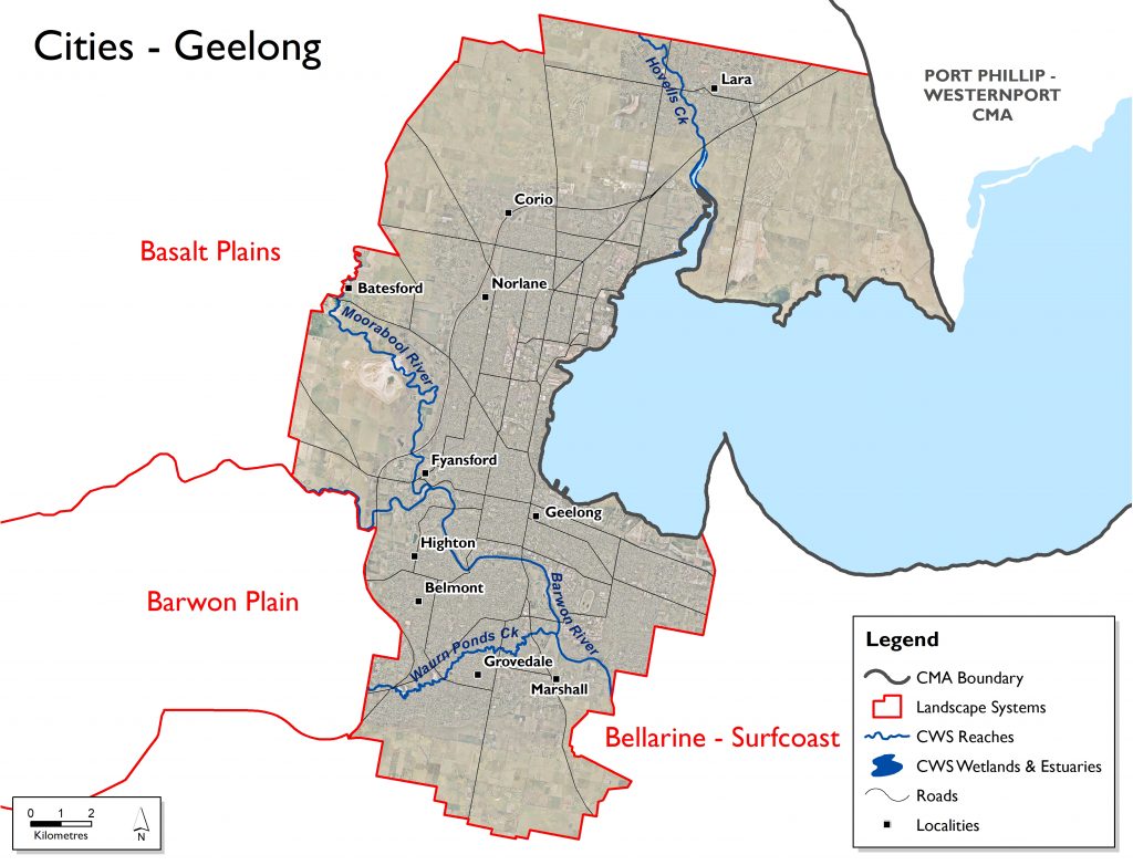
Overview
| Overall Area | 28,382 hectares |
| Population | 172,976 |
| Climate | 548 mm per annum at Geelong |
| Main Towns | Geelong Lara |
| Land Use | Residential Industry Commercial Grazing cattle sheep and horses |
| Main Industries | Manufacturing Education Services Agriculture Tourism |
| Main Natural Features | Barwon River Moorabool River Hovells Creek Waurn Ponds Creek Corio Bay Coastal Wetlands |
Landscape
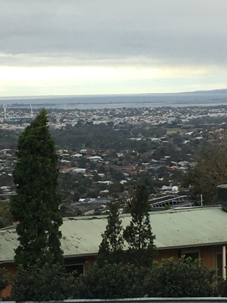
Geelong is the largest urban centre within the region with a population of over 250,000 and is forecast to be nearly 400,000 by the early 2040s. This landscape system extends south from Windemere Road, is enclosed by Corio Bay to the east as far as Point Henry and extends to the south, incorporating the Armstrong Creek growth area. To the west the designated growth areas are included. It contains parts of the City of Greater Geelong. The Traditional Owners are the Wadawurrung.
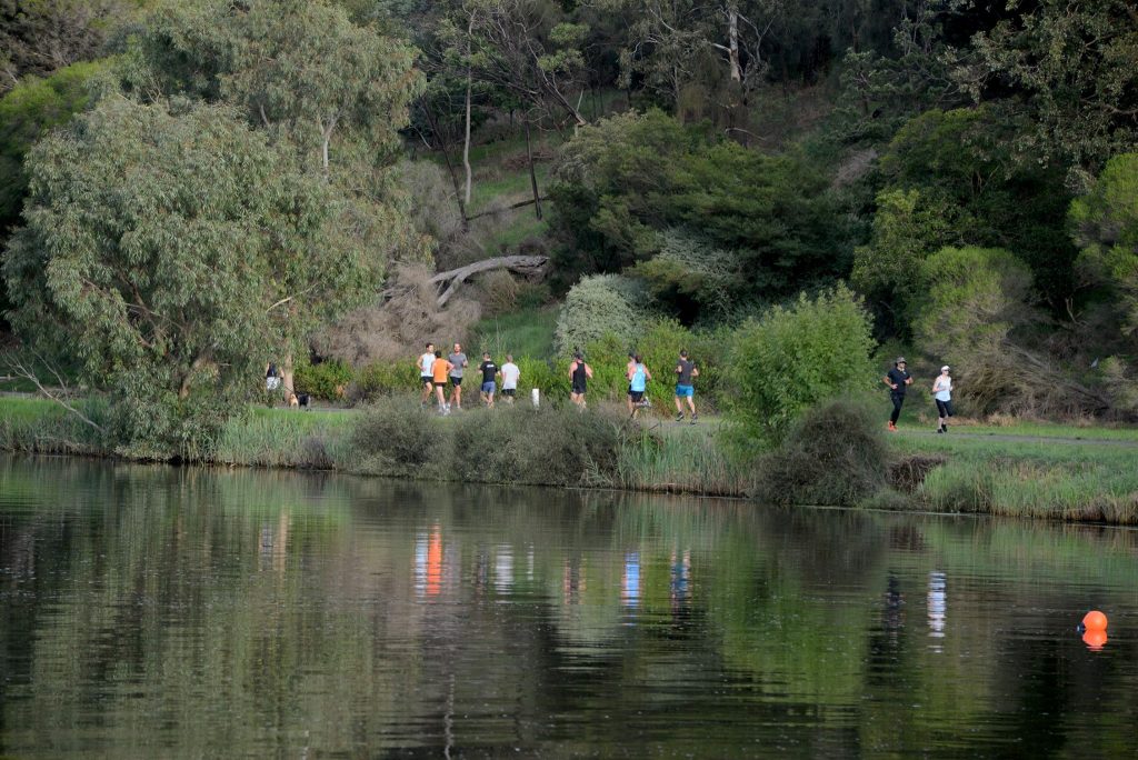
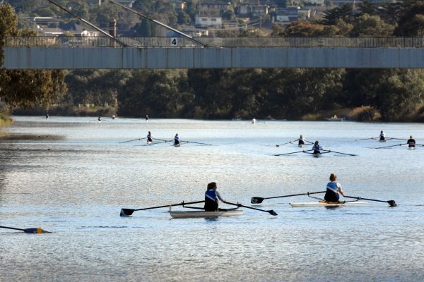
Limeburners Lagoon, which forms part of the Port Phillip Bay (Western Shoreline) and Bellarine Peninsula Ramsar site, is within this system, as are reaches of the Barwon River, Moorabool River, Waurn Ponds Creek and Hovells Creek which provide linear corridors for recreational and environmental values.
The Geelong landscape system encompasses the urban area of Geelong as well as the identified growth areas. A key area of responsibility for the Corangamite CMA is the management of a large stretch of the Barwon River for both environmental and recreational purposes. Other key issues for the CMA include flood plain and waterway statutory responsibilities. The CMA also has responsibility for the management of some key built assets, including the Barwon River barrage.
Livelihood
The Geelong City is principally an area for manufacturing, education, service provision, retail, tourism and residential activities. There is also limited agriculture, viticulture and horticulture occurring in the peri-urban areas around Geelong.
Lifestyle
Geelong City landscape system supports the largest population of the Corangamite region, with over 250,000 people, over 40% of the total population. Its population is concentrated in the urban areas of Geelong, as well as in the township of Lara.
Assessment of current condition and trends
Water
The Geelong City area is split between the Moorabool River Basin in the northern half, and the Barwon River Basin in the south. The area contains part of the lower Moorabool River, connecting with the Barwon river near Fyansford, west of Geelong’s urban centre. The Barwon River stretches south, with Waurn Ponds creek meeting the Barwon River in the south of the area. The Geelong City area also contains part of Hovells Creek separate to its other major waterways, flowing from the north past the town of Lara, into Limeburners Lagoon State Nature Reserve (part of the Port Phillip Bay (Western Shoreline) and Bellarine Peninsula Ramsar Site), into Corio Bay. All the waterways in the Geelong City area were assessed as being in very poor condition in the Index of Stream Condition in 2010.
The Geelong landscape system has part of the Barwon River flowing through it, which is part of a globally important bird conservation habitat, as well as habitat for Growling grass frog (nationally endangered).
The very poor condition of hydrology in the lower Barwon River and of the Barwon River Basin is attributed to reservoir operations in the Upper Barwon and Upper Moorabool areas that supply water to Geelong, Ballarat and neighbouring basins, and to the presence of the tidal barrage downstream of the reach.
The Moorabool River’s reach in the area has an extremely modified flow regime, often experiencing extended periods of low flow throughout summer and winter, as well as zero flow periods during summer.
Corangamite Waterwatch, a citizen science volunteer program, regularly monitors water quality parameters at many sites across the catchment. Data collected shows that as the Barwon River makes its way into Geelong after the confluence with the Moorabool River, the water quality is marginally degraded. High dissolved oxygen levels over summer indicate potential algal growth. In the past this section of the Barwon River through Geelong often experienced algal blooms over summer. The Jerringot and Pakington St wetlands on the banks of the Barwon River receive urban stormwater runoff. High phosphorus levels are common and may encourage macrophyte and algal growth which potentially creates oxygen troughs over the summer to autumn seasons and raises pH levels and ammonia toxicity. Macroinvertebrates indicate the water quality to be moderately impacted. The Waurn Ponds Creek, a tributary of the Barwon River, also displays poor water quality and at times of low flows has the potential for saline groundwater intrusion. The creek also has high phosphorus and turbidity levels. At the site there is a good cover of riparian vegetation, however there is potential for further bank erosion in this incised stream and the instream habitat for aquatic organisms is degraded. Macroinvertebrates indicate the creek is mildly impacted.
As the Barwon River enters the estuary at the lower breakwater the water quality is relatively healthy. During winter flooding, flows in the catchment completely flush the estuary of saltwater and becomes freshwater dominated. High turbidity occurs at this time, however is short lived and the tidal salt wedge pushes back up the estuary. Occasionally over summer as river flow declines, saltwater dominates.
The water quality in Hovells Creek over time was relatively healthy for an urban stream, maintaining low salinity, stable pH and mostly low turbidity. In recent times turbidity levels have increased, particularly in 2019, indicating an increase in sediment entering the stream – possibly due to unrestricted stock access, greatly reduced riparian vegetation in the catchment and urban development around Lara. Increases in sediment can smother habitat for aquatic macroinvertebrates and reduce the amount of light penetrating the water for submerged aquatic vegetation. Low dissolved oxygen levels indicate the waterway is impacted by high instream oxygen demand. A notable increase in nutrients such as phosphorus is also evident at times of increased turbidity. This is likely linked to urban runoff during times of high rainfall and farming practices in the catchment, whereby the phosphorus is imported to waterways attached to soil particles; when this makes its way into the waterways it has the potential to increase the growth of aquatic plants and even stimulate algal blooms. These have the potential to impact on the environment downstream.
The water quality in Cowies Creek was marginal. Urban development in the catchment may have contributed to this. , At times of reduced river flow over summer, salinity levels increase, possibly due to the ingression of saline ground water. At times of high rainfall and increased river flow, salinity reduces – however during these times turbidity and phosphorus levels increase. Turbidity and phosphorus levels have remained relatively low since 2014. This is common in urban waterways as pollutants enter via stormwater runoff during high rainfall events. The impact of increased nutrient levels within the creek can result in excessive aquatic macrophyte and potential algal growth. The dissolved oxygen levels in the water suggest this is occurring particularly over the warmer months. Low dissolved oxygen levels indicate there to be high instream oxygen demand at times. In Cowies Creek, the frequency of monitoring has reduced, but shows an overall improvement since 2014.
Biodiversity
The Port Phillip Bay (Western Shoreline) and Bellarine Peninsula Ramsar Site is located on the western shoreline of Port Phillip Bay. One of its six distinct wetland areas, Limeburners Bay, which is part of the coastal strip from Point Wilson to Limeburners Bay, falls into the Geelong City landscape system. Limeburners Lagoon (Hovells Creek Flora and Fauna Reserve) is a nature conservation reserve managed by Parks Victoria, and Limeburners Lagoon (State Nature Reserve) is managed by the City of Greater Geelong.
Nationally threatened ecological communities are present in this area, including seasonal herbaceous wetlands (freshwater) of the temperate lowland plains. This community is listed under the EPBC Act 1999 as critically endangered. It includes both the plains grassy wetland EVC, and the Victorian Volcanic Plains freshwater swamps EVC. These vegetation communities are isolated, freshwater wetlands that are usually inundated on a seasonal basis through rainfall, and then dry out, so surface water is not permanently present. They have a vegetation structure that is open, i.e. woody cover is absent to sparse, and the ground layer is dominated by herbs (grasses, sedges and forbs) adapted to seasonally wet or waterlogged conditions.
Subtropical and temperate coastal saltmarsh (coastal saltmarsh) also occur within the Port Phillip Bay (Western Shoreline) and Bellarine Peninsula Ramsar Site. The coastal saltmarsh ecological community was listed as vulnerable under the EPBC Act 1999 in August 2013. It occurs (generally) within a relatively narrow margin of the Australian coastline. It is found in areas under tidal influence, generally between the elevation of the mean high tide and the mean spring tide. It often occurs in association with estuaries and can support a large amount of coastal and wetland birdlife, including the critically endangered Orange-bellied Parrot.
The lower reach of the Moorabool, from She Oaks weir (in the Northern Uplands landscape system) to the confluence with the Barwon River, contains eight species of native fish including Tupong, Southern pygmy perch, Australian grayling (listed as vulnerable under the EPBC Act 1999), Common galaxid and Spotted galaxid (ARI, 2015). Weirs in this reach are a significant barrier to fish. These barriers have increased the extent of slow flowing habitat and reduced habitat diversity in the lower reach of the Moorabool. However, recent scientific research has identified that high river flows in 2010-11 contributed significantly to recolonisation of migratory and estuarine fish species in the lower reach, highlighting the importance of high flows in creating habitat linkages between weirs in the Moorabool (ARI, 2015).
The Barwon River supports a range of significant riparian and waterway birds, and fish: Magpie Goose (Anseranas semipalmata), Eastern Great Egret (Ardea modesta), Lewin’s Rail (Rallus pectoralis), Australasian Bittern (Botaurus poiciloptilus), Caspian Tern (Hydroprogne caspia, Nankeen Night Heron (Nycticorax caledonicus), Yarra Pygmy Perch (Nannoperca obscura), Australian Grayling (Prototroctes maraena), Australian Mudfish (Neochanna cleaveri).
It is a diverse landscape a with a mix of salt dependent / salt tolerant / non-salt tolerant vegetation communities with the highest biodiversity values being in the public land blocks, the thin shoreline strip and the wetlands.
Land
Relative soil productivity on private agricultural land in the Geelong City area is the lowest of the Corangamite region.
DELWP’s Victorian Land Cover Time Series provides a snapshot of the changes in land cover types in seven five-year increments between 1985-2019. The two cities in the region, the Geelong and Ballarat city landscape systems, are dominated by urban land cover, followed by non-native pasture as the second most prevalent land cover. Across both landscape systems, urban areas have increased from around 26% to almost 34% over the time period, whilst non-native pasture decreased from around 31% to 22% today. Dryland cropping, and native grass herb also each constitute 12% and 8% respectively, Dryland cropping has increased in land area by >50% since the 1985- 1990 epoch, overtaking native grass herb in total area covered (which has remained constant).
Both seasonal and perennial wetland types dropped by nearly 25% each, although seasonal wetlands occupy ten times the area of perennial wetlands. Mangroves and Saltmarsh in the Geelong City landscape system stayed constant over the time period.
Coast and Marine
Most of the coastline within the Geelong City landscape system is built or substantially modified to accommodate the Port of Geelong. Corio Bay is used for a variety of purposes including recreation, transport and industry with a history of heavy industries including refineries, manufacturing and port facilities within its immediate area. Corio Bay is also surrounded by heavy areas of residential and commercial development.
Community
Geelong City landscape system supports the largest population of the Corangamite region, with in excess of 250,000 people, over 40% of the total population. Its population is concentrated in the urban areas of Geelong, as well as in the township of Lara.
Batesford-Fyansford-Stonehaven, Barrabool Hills, Corio and Avalon Landcare Groups operate within the Geelong landscape system and are supported by the Geelong and Bellarine Landcare Networks.
The Geelong Environment Council (GEC) was formed in 1972 to assist in the protection of the environment in and around Geelong.
Geelong Sustainability is a community group focused on sharing information, building community resilience, advocating for the environment and supporting effective action.
Other environmental groups:
- Australian Plants Society – Geelong
- Dog Rocks Flora and Fauna Sanctuary
- Geelong Field Naturalists’ Club
- Fishcare Victoria Inc – Geelong and Bellarine
- Friends of Buckley Falls
- Friends of Geelong Botanic Gardens
- Geelong Environment Council Inc
- Greening Geelong West Inc
- Serendip Sanctuary Volunteers
- St Luke’s Uniting Church Environment Action Group
- Victorian Serrated Tussock Working Party
- Wathaurong Aboriginal Community Co-op
Major threats and drivers of change
Urban growth has placed pressure on existing infrastructure, water resources and land use, with the potential for associated impacts to adversely affect the values of the area. Threats linked to urban development and increased recreational use include storm water run-off and degraded water quality, soil disturbance, bank erosion and degradation of native riparian and estuarine vegetation.
Water
The greatest threat to the Barwon and Moorabool Rivers flowing through the Geelong City Landscape system occurs from up-stream landuse and consumptive water extraction. The combined effects of groundwater extraction in the Upper Moorabool River catchment near Ballarat combined with water stored in farm dams and water extracted for town water supply, industrial and stock purposes has resulted in significantly reduced flows in both the Moorabool and Barwon Rivers. The recent Long Term Water Resource Assessment showed that flows in the Barwon and Moorabool Rivers had declined by 11% and 20% since 2006 respectively. The declining trend in flows is predicted to continue due to the impacts of climate change. Furthermore, agriculture and land clearing in the catchments causes increased river turbidity and nutrient loads resulting in algal blooms and reduced fish habitat.
The increase in population for the Greater Geelong area to a predicted 400,000 by 2040 will add significant pressure to water resources in an already flow stressed system. The greater Geelong region’s drinking water is sourced mainly from forested catchments on the upper Barwon and Moorabool rivers. During dry conditions, additional water can be drawn from the Victorian water grid via the Melbourne to Geelong Pipeline, and from an underground aquifer in Anglesea. The Central and Gippsland Sustainable Water Strategy currently in development will set out the plan to address the increasing water demand resulting from a rapid population growth combined with a decreasing supply resulting from climate change.
Parts of Hovells Creek and associated tributaries and wetlands have been subjected to grazing pressures. Livestock access to waterways can erode banks, damage riparian vegetation and reduce water quality through sedimentation and effluent contamination.
Additional threats to the waterways of the area include reduced vegetation width and riparian connectivity; degraded riparian and estuarine vegetation; reduced estuary extent, bed instability and degradation; change in the flow regime and invasive flora and fauna.
The Corangamite Waterway Strategy 2014-2022 outlines priority management activities to address water quality threats in the Geelong landscape. These include:
- Establish terrestrial pest animal control – fox control (Hovells Creek, Limeburners Lagoon)
- Establish native indigenous vegetation (Hovells Creek, Limeburners Lagoon)
- Install riparian/wetland fencing (Hovells Creek, Limeburners Lagoon)
- Undertake non-woody weed control (Limeburners Lagoon)
- Establish stewardship/management agreement (Hovells Creek, Limeburners, Lagoon)
- Implement best management practice on grazing properties (Hovells Creek, Limeburners Lagoon)
- Investigate and manage urban stormwater/water quality impacts (Hovells Creek, Limeburners Lagoon, Barwon River)
- Investigate options for and management of weir under Old Melbourne Road (Limeburners Lagoon)
- Implementation of the Port Phillip Bay (Western Shoreline) and Bellarine Peninsula Ramsar Site Management Plan
- Undertake assessment and management of fish barriers in the Barwon and Moorabool catchments
- Establish invasive species assessment and management
- Investigate stream instabilities
- Undertake an assessment of instream habitat (large wood) density
- Implement the Barwon through Geelong Management Plan and Barwon River Parklands Strategy
- Maintain the discharge into the Moorabool River from Batesford Quarry as a beneficial environmental use – as per the Central Region Sustainable Water Strategy (Moorabool River)
- Maintain Waterwatch groups collecting baseline data on waterway condition
Biodiversity
Disturbance to migratory shorebirds from recreational activities is a key threat to shorebirds in and around Limeburners Lagoon and along coastal wetlands. Other threats include native vegetation removal, barriers to on-ground management, water quality and quantity, rising sea levels, littering and inappropriate land use.
There are a number of endangered Ecological Vegetation Classes in this landscape system including Coastal Saltmarsh, Plains Grassy Woodland, Creekline Grassy Woodland, Plains Grassland, Coastal Saltmarsh/Mangrove Shrubland Mosaic and Natural Damp Grasslands of the Victorian Coastal Plains.
Land
Land use change is a major issue within the Geelong City landscape system, especially with the designated growth areas expanding into areas that were previously used for agriculture.
Coast and Marine
The Victorian Marine and Coastal Policy identifies that the health of the marine and coastal environment is under threat from multiple sources, including climate change and growth in towns, cities and industries that interact with their local marine and coastal ecosystems.
These threats can lead to negative impacts on water quality and quantity, pollution and debris, invasive species, marine pests and diseases, disturbance and loss of plants and animals, and loss of access to beaches from the effects of sea walls, infrastructure and erosion. Degradation occurs over time and space, and the impacts in marine and coastal areas are varied and complex.
Climate change is increasing the pressure on the marine and coastal environment by exacerbating existing threats and introducing new ones, including:
• rising sea levels, leading to more inundation and erosion
• increased frequency and severity of storms and other extreme weather events
• changes in ocean temperatures, currents and acidification
• changes to waterway flows, levels and regimes
• changes in the range, distribution and abundance of both introduced and native plants and animals, taking advantage of a changed climate.
There are a number of locations along the Geelong City coastline that are already susceptible to erosion, including high use areas such as Rippleside and Eastern Beach. This will be increased under climate change scenarios, especially with the prediction of increased frequency of storms and extreme weather events. Sea level rise under climate change will have a major effect on low lying coastal areas, particularly around Limeburners Lagoon and Moolap. This has led the City of Greater Geelong to introduce a Land Subject to Inundation Overlay into its planning scheme to manage development in affected areas.
Growth in resident populations and visitor numbers puts pressure on the health of the marine and coastal environment. Population growth also increases pressure on recreational infrastructure such as walking tracks and visitor facilities. This, in turn, leads to more demand for alterations to beaches, foreshores, wetlands and natural processes through groynes, sea walls and dredging to support use and development.
Community
Geelong City landscape system supports the largest population of the Corangamite region, withover 250,000 people, being over 40% of the total population of the Corangamite region.
The Geelong Landcare Network and Bellarine Catchment Group are the primary support organisations for land and water management in this system. There are also a number of other environmental based organisations within the city and surrounds. A key issue for these organisations is maintaining membership and preventing member burn out.
Geelong City 6 Year Outcomes
Water
By 2027, compared to 2022 baselines:
The efficiency of consumptive water use in the Geelong City Landscape System will be improved through the use of cost effective alternate water sources and demand management strategies that results in less take from source water. GeeWO1
There is an improvement in riparian extent and condition, hydrological regimes and water quality of the lower Moorabool and Barwon rivers. GeeWO2
The efficiency of consumptive water use from our priority waterways will be improved though use of cost effective alternative water sources and demand management strategies within the Geelong City Landscape System. GeeWO3
Improve waterway amenity through the implementation of the Kitjarra-dja- bul bullarto langi-ut Masterplan. GeeWO4
Maintain or improve the ecological character of the Port Phillip Bay (Western Shoreline) and Bellarine Peninsula Ramsar complex. GeeWO5
The impact of urban development on riparian buffers, water quality and flow in the Barwon River and its tributaries within the Geelong City Landscape System will have been reduced. GeeWO6
Understand and enhance the Wadawurrung values of the Barwon River and tributaries and ensure the Wadawurrung People have a strong voice in their management. GeeWO7
There will have been an increase in the Barwon River in-stream habitat for native fish and angling species compared to 2021 baseline. GeeWO8
Biodiversity
By 2027, compared to 2022 baselines:
Achieve a net gain in the overall extent, connectivity and condition of Geelong habitats across land, waterway and coastal environments. GeeBO1
Achieve a net gain where possible in suitable Geelong habitat expected over six years from sustained improved public and private land management and community involvement for threatened and culturally significant local species. GeeBO2
Achieve a net gain where possible in all species with positive % change in suitable Geelong habitat expected over six years from sustained improved public and private land management and community involvement. GeeBO3
Increase effectiveness of interagency collaboration in their ability to respond to climate change and development pressures on biodiversity. GeeBO4
Increase understanding and awareness of biodiversity values of the Geelong City Landscape System. GeeBO5
Land
By 2027, compared to 2022 baselines, land is suitably used within its capability and sustainably managed to maintain and improve its natural capital. GeeLO1
Coast and Marine
By 2027, compared to 2022 baselines, proactive management of the catchment by the community contributes to a net gain in the health and resilience of the region’s highly valued coastal and marine environment. GeeMO1
Communities
By 2027, compared to 2022 baselines:
Geelong City communities (and visitors) are encouraged, educated and enabled to further connect with and responsibly care for the natural environment. GeeCO1
Geelong City communities (and visitors) have an increased awareness and understanding of the connection between human activities and impacts on the environment. GeeCO2
The increased capacity of the Wadawurrung Traditional Owner Group enables their increased involvement in decision making that effects their Country. GeeCO3
Geelong City 6 Year Priority Directions
Six year regionally applicable priority directions have been developed for each of the Themes and are applicable to this landscape System, these can be accessed via the following links:
Six year priority directions for Geelong City are provided in the following table. Where these priority directions apply to a theme this is indicated by the relevant shading. To access definitions of terms and acronyms click on the following link.
Code |
Priority Direction |
Relevant Theme | ||||||
|---|---|---|---|---|---|---|---|---|
| Water | Biodiversity | Land | Community | Coast and Marine | Lead | Collaborators | ||
| GEE1 | Geelong City landscape partners and the community collaborate to deliver a coordinated approach to natural resource management to build resilience and successfully respond to changing circumstances with clear roles and responsibilities communicated. | CCMA | DELWP, BW, EPA, CoGG, PV | |||||
| GEE2 | Develop enduring partnerships with the Wadawurrung people to: 1) acknowledge and enhance Wadawurrung values of natural assets; 2) ensure the Wadawurrung people have a strong say in management of natural assets; 3) identify and implement appropriate mechanisms for sharing Traditional Owner stories and history; and, 4) identify and implement opportunities for the Wadawurrung people to own and manage water on their country |
CCMA | WTOAC, DELWP, BW, CoGG | |||||
| GEE3 | Best land management practices are implemented across peri-urban land managers, agencies, developers, and the catchment community | CCMA | AgVic, Landcare, CoGG | |||||
| GEE4 | Enhance riparian management within priority waterways of the Geelong system as defined in the Corangamite Waterway Strategy and improve in-stream habitat in priority areas along the Lower Barwon River. | CCMA | CoGG, BW, PV, OzFish, VRFish | |||||
| GEE5 | Ensure development planning considers, minimises and where possible avoids adversely impacting floodplains, biodiversity, land and water assets including encouraging water sensitive urban design and use of integrated water management principles and requiring developers to: 1) protect and enhance native vegetation and habitat 2) protect and enhance floodplain function 3) protect and enhance coastal and marine environments 4) protect cultural heritage |
CoGG | CCMA | |||||
| GEE6 | Explore and implement cost effective water efficiency measures including demand reduction initiatives and alternative water sources by implementing the following plans and strategies: 1) Barwon Water Urban Water Strategy 2) priority projects identified by the Barwon Integrated Water Management Forum; and, 3) relevant actions from the 2021 Central and Gippsland Sustainable Water Strategy |
BW | CCMA, CoGG, DELWP | |||||
| GEE7 | Continue to implement the 2018 Port Phillip Bay (Western Shoreline) and Bellarine Peninsula Ramsar Site Management Plan including monitoring actions from the Ramsar site MERI Plan. | CCMA | CoGG, DELWP, PV, PPWCMA, ARI, BLA, MW | |||||
| GEE8 | Provide the public with clear guidance on episodes of poor water quality such as blue-green algae outbreaks in waterways such as the Barwon River through Geelong | CCMA | CoGG, BW | |||||
| GEE9 | Develop an integrated masterplan for Kitjarra-dja- bul bullarto langi-ut (Barwon River Parklands) and implement high priority projects. | CCMA | CoGG, BW, PV, Tourism Greater Geelong and the Bellarine, WTOAC, DELWP, GPS, G21, DHHS, SRV, BC | |||||
| GEE10 | Investigate the water balance of the lower Barwon River considering development implications, runoff and future management implications. | CCMA, CoGG |
DELWP | |||||
| GEE11 | Encourage landowners to apply best practice land management by: 1) using property management planning; 2) use of Landcare networks; 3) actively researching and facilitating market drivers that promote sustainable agriculture /land management practices; and, 4) designing and delivering a comprehensive engagement program to support and empower farming communities |
CCMA | AgVic, DELWP, Landcare | |||||
| GEE12 | Ensure community education and engagement activities are grounded in the most recent and relevant social research available and target local demographics. | CCMA | DELWP, CoGG, BW, PV | |||||
| GEE13 | Manage upstream processes to mitigate impacts on the coastal and marine environments. | CCMA | EPA, CoGG, DELWP, Landcare | |||||
| GEE14 | Explore carbon sequestration opportunities to deliver both climate and catchment/biodiversity benefits. | Deakin Uni | DELWP, PV, CCMA | |||||
| GEE15 | Within the Coastal and Marine environment 1) review targets in relevant strategies to identify and reduce stressors on coastal and marine environments 2) develop and implement a process for the provision of coastal erosion advice for long term planning, management and adaptation. |
DELWP | CCMA, CoGG, | |||||
| GEE16 | Encourage and enable community participation (volunteering) 1) in on-ground environmental works to restore and protect environmental assets 2) citizen science programs. |
CCMA | CoGG, Landcare | |||||
| GEE17 | Engage with the community on the need to mitigate and adapt to climate change and its impacts. | CoGG | CCMA, DELWP | |||||
| GEE18 | Design and deliver a comprehensive education program to engage new urban and peri-urban communities in the growth corridors to connect them with their local environment and empower them to participate in NRM activities. | CoGG | CCMA | |||||
| GEE19 | Action Plans are developed that leads to a 25% increase of non-government investment to supplement current Government investment into the region to address high priority natural resource management actions | CCMA | DELWP, CoGG, Landcare | |||||
| GEE20 | Develop best practice management actions to achieve an overall net gain of ‘Suitable Habitat’ for priority species by 2027 | CCMA | DELWP | |||||
| GEE21 | Implement 90% of recommendations within the Barwon River Masterplan by 2027 | CCMA | CoGG, BW | |||||
| GEE22 | Implement additional areas of sustained predator, herbivore and weed control in priority locations, reflecting Biodiversity Response Planning outputs, Strategic Management Prospects and other regional plans | DELWP | CCMA, CoGG, PV | |||||

