One of ten Catchment Management Authorities in Victoria
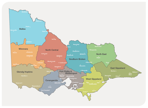
The Corangamite Catchment Management Authority’s region is one of ten regions in Victoria set up under the Catchment and Land Protection Act of 1998.

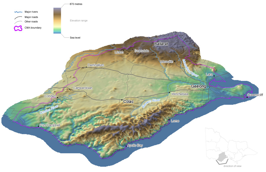
Located in the south of Victoria, the region stretches from the Bellarine Peninsular to the east, south to Cape Otway and north to Ballarat and includes the Corangamite, Otway Coast, Barwon and Moorabool drainage basins.

Regional features and assets
The Corangamite region is rich in cultural, environmental, social and economic values. The region extends across:
- 1.3 million ha of land, with 78% in private ownership
- 175 km of coast
- four catchment basins – Barwon, Lake Corangamite, Otway Coast and Moorabool.
The Corangamite region has formed through landscape-building episodes over the past 600 million years, in a variety of environments ranging from deep sea sedimentation to explosive volcanoes. Landscapes continually evolve and processes such as earthquakes, landslides and even saline groundwater discharge, are manifestations of this evolutionary process.
The Corangamite region has rich and diverse landscapes, reflecting its geological, climatic and human history. The natural resources of our region are critical to sustaining the lifestyle of its residents and visitors, as well as providing important habitat for flora and fauna. They support valuable industries such as agriculture and nature-based tourism and underpin the region’s urban water supply needs.
The region includes all or part of the cities of Ballarat and Greater Geelong, the Borough of Queenscliffe, and the Shires of Colac Otway, Corangamite, Golden Plains, Moorabool, Moyne, and Surf Coast.
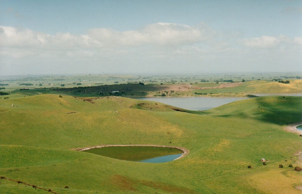
Notable features of the region include Lake Corangamite, the largest permanent saline lake in Australia and the largest natural lake in Victoria, which is a Ramsar listed wetland and a haven for migratory and non-migratory birds. The Western District Lakes Ramsar site covers approximately 33,000 hectares and comprises nine separate lakes, which lie to the west, north and east of Colac.
The Corangamite region was one of the first regions of European settlement in Victoria. Settlers attracted to the open grassland plains moved rapidly inland from Geelong and Portland to establish grazing runs. The tall forests of the Otways attracted timber cutters in search of resources to establish the rapidly growing cities and towns of the colony. The gold rush of the mid-19th century promoted very rapid population growth around Ballarat. By the start of the 20th century, subdivision of the original grazing runs saw the establishment of more intensive agricultural industries such as dairying and cropping.
The range of coastal environments includes sandy beaches, rocky headlands, estuaries and bays, and the cliffs, caves and sea stacks of the Shipwreck Coast. The adjoining Otway Ranges are highly valued with their deeply incised rivers, gorges, rapids and waterfalls and extensive forests.
The region contains a variety of parks and reserves, including the Port Campbell and Great Otway National Parks, the Twelve Apostles and Point Addis Marine National Parks and part of the Brisbane Ranges National Park. The rivers and waterways of the region underpin water supplies to towns and cities.
The region’s widespread, diverse and productive landscapes support forests, cropping, grazing, horticulture, viticulture and dairy enterprises. The economy of the region reflects its mix of agricultural and other primary industries, tourism, manufacturing and service industries. Agriculture, Forestry and Fishing is just outside the top 10 employers in the region at number 11 with 5,939 in 2016, or 3% of the total workforce. Healthcare (15%), retail trade (11%) and education and training (10%) made up the top three employers in 2016. Mixed farming and grazing is the predominant agricultural land use in the Corangamite region (66%), followed by dairy (14%), beef (7%) and sheep (5%) production.
Traditional Owners
Aboriginal peoples have lived in the area now known as the Corangamite region for thousands of generations. Wadawurrung Country stretches from the Great Dividing Range of Ballarat to the coast, from the Werribee River to along the Surf Coast, including Geelong, the Bellarine Peninsula. The Eastern Maar are Traditional Owners of south-western Victoria. Their land extends as far north as Ararat and encompasses the Warrnambool, Port Fairy and Great Ocean Road areas.

Regional communities
The presence of the cities of Geelong and Ballarat plays a large role in shaping population growth and distribution in the Corangamite region. As Victoria’s second largest city, Geelong is an important service centre in south west Victoria. With its close proximity to Melbourne, Geelong is increasingly being seen as a major urban growth location within the broader Melbourne context. Ballarat, too, is experiencing strong population growth as its role as a regional service centre expands. The western area of Melbourne is experiencing rapid growth and this will have an impact on both Geelong and Ballarat in future. Future growth is also expected in the peri-urban municipalities of Surf Coast, Golden Plains and Moorabool.
The economy of the region reflects its mix of agricultural and other primary industries, tourism, manufacturing and service industries. Agriculture is the dominant land use of the region. The domestic and international tourism industry is a significant employer in the Corangamite region, especially in the Bellarine and Surfcoast, Otway Coast and Heytesbury landscape systems. Many of the smaller townships within the region rely on and support the agricultural and tourism industries.
A trend towards lifestyle change has seen larger properties previously used for agricultural production being divided up into smaller holdings. This has especially been the case in the peri-urban areas around Geelong and Ballarat and in the Bellarine and Surf Coast landscape systems.
Challenges and drivers of change
Climate change presents the greatest long-term challenge for the Corangamite region. The future climate of the region is expected to be hotter and drier than today with a higher frequency of extreme weather events such as bushfires and floods. Victorian Climate Projections covering the Corangamite region forecast that both maximum and minimum temperatures will continue to increase. Extreme rainfall events are predicted on average to increase in intensity but remain highly variable in space and time. The region’s native vegetation, waterways, wetlands and soil are vulnerable to a hotter, drier climate. The region’s estuaries and coastal wetlands are vulnerable to sea level rise.
In the short and mid term the increase in urbanisation, especially around major centers such as Geelong and Ballarat, has seen areas that were previously used for primary production being utilised for urban and peri-urban settlements. Demand for coastal real estate has also placed a heavy burden on our marine and coastal areas. The need for water has also increased as the population of the region continues to grow.
With regard to agriculture across the region, emerging trends include:
- fewer farmers
- enterprise changes
- smaller properties
- less income from agriculture
- older farmers.
More than 70% of land in the region is privately owned, presenting significant challenges in engaging with land owners and managers. There is concern about the viability of rural communities with socio-economic issues related to an ageing population, the loss of important services and reduced employment opportunities becoming more relevant.
Landscape Systems
The region has been divided into nine sub regional landscape systems. These have been developed based on the principles of Landscape (the visible features of an area of land), Livelihood (how the land is used for productive purposes) and Lifestyle (the way that people live) with areas having common traits relating to these providing the basis for the local areas. These are Northern Uplands, Basalt Plains, Western District Lakes, Heytesbury, Otway Coast, Barwon Plains, Bellarine & Surf Coast, Geelong City and Ballarat City.
The process used in the development of these geographic areas can be refined further if required within each landscape system. It is important to enable people to relate spatially to an area and that recognised points of reference can be identified. This has meant that in some situations “best fit” principles have been used in defining these areas. Major roads have been used in some situations, while public land boundaries have also been used where suitable.
Further refinement of each landscape system for both engagement and delivery purposes can be based around communities. Depending on the landscape system, community networks such as landcare groups/networks, fire brigades, commodity groups, proximity to townships, municipalities etc could be used to further reflect local priorities.


